Archivo:USACE Perdido Bay.jpg
Tamaño de esta previsualización: 800 × 575 píxeles. Otras resoluciones: 320 × 230 píxeles · 640 × 460 píxeles · 1024 × 737 píxeles · 1280 × 921 píxeles · 1500 × 1079 píxeles.
Ver la imagen en su resolución original (1500 × 1079 píxeles; tamaño de archivo: 438 kB; tipo MIME: image/jpeg)
| Descripción |
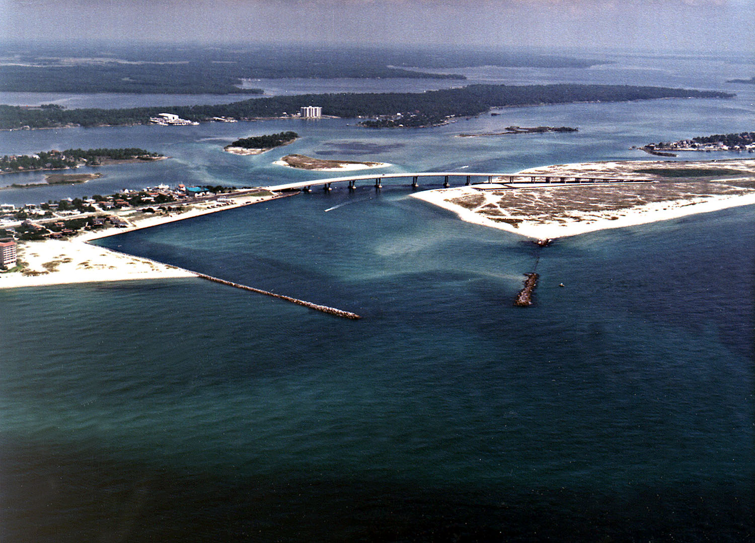
English: Perdido Pass, the mouth of the Perdido River and Perdido Bay on the Gulf of Mexico at Orange Beach, Alabama, USA. Alabama State Route 182 crosses the inlet. The image description on the USACE source page has misidentified the highway on the bridge as U.S. Route 98. |
|||
| Localización | Orange Beach, Alabama, USA 30°16′40.96″N 87°33′18.72″W / 30.2780444°N 87.5552°W |
|||
| Fecha | not specified | |||
| Fuente |
U.S. Army Corp of Engineers Digital Visual Library Digital Visual Library home page Image page Image description page |
|||
| Autor | Adrien Lamarre, U.S. Army Corps of Engineers | |||
| Permiso (Reutilización de este archivo) |
|
Historial del archivo
Haz clic sobre una fecha y hora para ver el archivo tal como apareció en ese momento.
| Fecha y hora | Miniatura | Dimensiones | Usuario | Comentario | |
|---|---|---|---|---|---|
| actual | 04:35 14 mar 2007 | | 1500 × 1079 (438 kB) | DanMS | {{Information | Description = Perdido Pass, the mouth of the Perdido River and Perdido Bay on the Gulf of Mexico at Orange Beach, Alabama, USA. Alabama State Route 182 crosses the inlet. The image description on the USACE source page has misidentified the |
Usos del archivo
La siguiente página usa este archivo:
Uso global del archivo
Las wikis siguientes utilizan este archivo:
- Uso en ar.wikipedia.org
- Uso en ceb.wikipedia.org
- Uso en de.wikipedia.org
- Uso en en.wikipedia.org
- Uso en fr.wikipedia.org
- Uso en ru.wikipedia.org
- Uso en www.wikidata.org