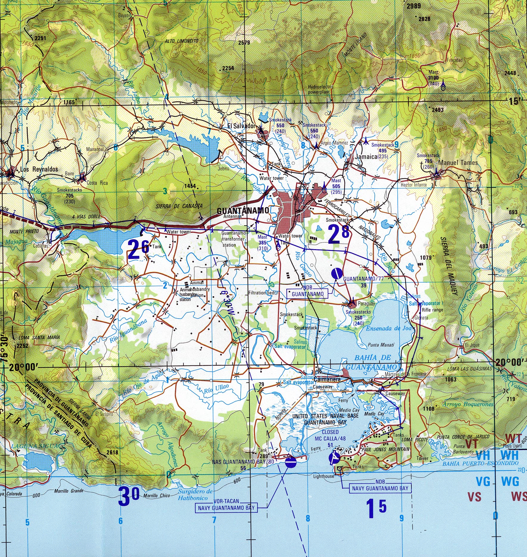
Archivo:A CIA map of the guantanamo region, as of 1996.jpg
Tamaño de esta previsualización: 567 × 599 píxeles. Otras resoluciones: 227 × 240 píxeles · 454 × 480 píxeles · 727 × 768 píxeles · 969 × 1024 píxeles · 1769 × 1869 píxeles.
Ver la imagen en su resolución original (1769 × 1869 píxeles; tamaño de archivo: 1,6 MB; tipo MIME: image/jpeg)
| Descripción |
A CIA map of the guantanamo region, as of 1996.jpg The original page says: "The following maps were produced by the U.S. Central Intelligence Agency, unless otherwise indicated." The original page says: "Guantanamo (Joint Operations Graphic) 1996 (1.6MB) Portion of Santiago De Cuba, Cuba, Joint Operations Graphic (AIR), Series 1501 AIR, Sheet NF 18-14, Edition 5. Original scale 1:250,000. U.S. National Imagery and Mapping Agency, compiled April 1988, revised July 1995, air information current through 27 July 1996. Not for navigational use " |
|||
| Fecha | ||||
| Fuente | http://www.lib.utexas.edu/maps/cuba.html | |||
| Autor | CIA | |||
| Permiso (Reutilización de este archivo) |
|

Historial del archivo
Haz clic sobre una fecha y hora para ver el archivo tal como apareció en ese momento.
| Fecha y hora | Miniatura | Dimensiones | Usuario | Comentario | |
|---|---|---|---|---|---|
| actual | 21:57 6 abr 2011 | | 1769 × 1869 (1,6 MB) | Geo Swan | {{Information |Description=A CIA map of the guantanamo region, as of 1996.jpg The original page says: ''"The following maps were produced by the U.S. Central Intelligence Agency, unless otherwise indicated."'' The original page says: ''"Guantanamo (Join |
Usos del archivo
La siguiente página usa este archivo: