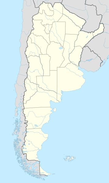
Archivo:Argentina adm location map.svg

Ver la imagen en su resolución original ((Imagen SVG, nominalmente 1276 × 2149 pixels, tamaño de archivo: 850 kB))
Resumen
| Descripción |
Deutsch: Positionskarte von Argentinien
English: Location map of Argentina
|
||||||||||||
| Fecha | |||||||||||||
| Fuente |
Trabajo propio utilizando:
|
||||||||||||
| Autor | NordNordWest | ||||||||||||
| Otras versiones | File:Argentina topo location map.jpg | ||||||||||||

|
Este mapa se ha hecho o mejorado en el Kartenwerkstatt (taller cartográfico) alemán. También puede proponer mapas para mejorar.
|
Licencia
Usage of this file with:

explanatory notes: Legally binding is only the full legalcode. For a free usage I recommend to respect the following licence conditions:
1. Provide my name as given above: NordNordWest,
2. a copy of, or the URI for, the applicable license: https://creativecommons.org/licenses/by-sa/3.0/de/legalcode,
3. the title of the work,
4. in the case of an adaptation, a credit identifying the use of the work in the adaptation.
This license and the rights granted hereunder will terminate automatically upon any breach by you of the terms of this license. Any of the above conditions can be waived if you get permission from the copyright holder. If you have questions or wish differing conditions, please contact me through nnwest or my discussion page ![]() t-online.de
t-online.de
- Eres libre:
- de compartir – de copiar, distribuir y transmitir el trabajo
- de remezclar – de adaptar el trabajo
- Bajo las siguientes condiciones:
- atribución – Debes otorgar el crédito correspondiente, proporcionar un enlace a la licencia e indicar si realizaste algún cambio. Puedes hacerlo de cualquier manera razonable pero no de manera que sugiera que el licenciante te respalda a ti o al uso que hagas del trabajo.
- compartir igual – En caso de mezclar, transformar o modificar este trabajo, deberás distribuir el trabajo resultante bajo la misma licencia o una compatible como el original.

Historial del archivo
Haz clic sobre una fecha y hora para ver el archivo tal como apareció en ese momento.
| Fecha y hora | Miniatura | Dimensiones | Usuario | Comentario | |
|---|---|---|---|---|---|
| actual | 19:29 24 oct 2021 | | 1276 × 2149 (850 kB) | GrandEscogriffe | borders of Santiago del Estero |
| 23:16 24 dic 2017 |  | 1276 × 2149 (849 kB) | Janitoalevic | fixed part of the border | |
| 23:52 16 may 2016 |  | 1276 × 2149 (848 kB) | Janitoalevic | Added Magellan Strait and Beagle Channel Border and fixed small issues in the continental border. | |
| 02:32 24 feb 2016 |  | 1276 × 2149 (849 kB) | Janitoalevic | Fixed Border | |
| 02:18 24 feb 2016 |  | 1276 × 2149 (843 kB) | Janitoalevic | The Southern Part of the Southern Patagonian Ice Field Limit was defined in 1998, in the same threathy that says that part of the limit is undefined until both countries solve that. Both countries have claiming over the undefined part and is explained... | |
| 19:03 28 abr 2015 |  | 1276 × 2149 (845 kB) | NordNordWest | == {{int:filedesc}} == {{Information |Description= {{de|1=Positionskarte von Argentinien}} {{en|1=Location map of Argentina}} {{Location map series N (conic)|top=-21.5|longitude=-64|latitude1=-34|latitude2 = -44|bottom = -56.5}} |Source={{Own using}}... |
Usos del archivo
Las siguientes páginas usan este archivo:
Uso global del archivo
Las wikis siguientes utilizan este archivo:
- Uso en als.wikipedia.org
- Uso en de.wikipedia.org
- Buenos Aires
- Tandil
- Ushuaia
- Fußball-Weltmeisterschaft 1978
- Campo del Cielo
- Córdoba (Argentinien)
- San Miguel de Tucumán
- Fußball-Weltmeisterschaft 1978/Deutschland
- Villa Carlos Paz
- Cuesta Blanca
- Río Cuarto
- Villa María
- San Francisco (Córdoba)
- Comodoro Rivadavia
- Rosario (Santa Fe)
- Río Grande (Tierra del Fuego)
- Mendoza (Argentinien)
- San Salvador de Jujuy
- Neuquén (Stadt)
- Nationalpark Los Glaciares
- Salta (Stadt)
- San Nicolás de los Arroyos
- Quilmes (Stadt)
- Quilmes (Befestigungsanlage)
- Santiago del Estero
- La Plata (Argentinien)
- Bariloche
- Humahuaca
- Tilcara
- Sierra del Medio
- Paraná (Entre Ríos)
- Viedma
- Santa Rosa (La Pampa)
- Rawson
- Mar del Plata
- Las Grutas
- Puerto Madryn
- Tartagal
- Santa Fe (Argentinien)
- Resistencia
- Trelew
- Río Gallegos
- Caleta Olivia
- Lobos
- Campeonato Sudamericano 1916
- Posadas
- Villa Gesell
- Villa General Belgrano
Ver más uso global de este archivo.