Archivo:Macedonia topography-en.svg

Ver la imagen en su resolución original ((Imagen SVG, nominalmente 920 × 652 pixels, tamaño de archivo: 4,25 MB))
Resumen
| Descripción |
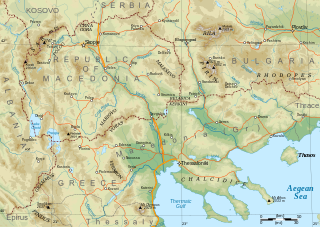
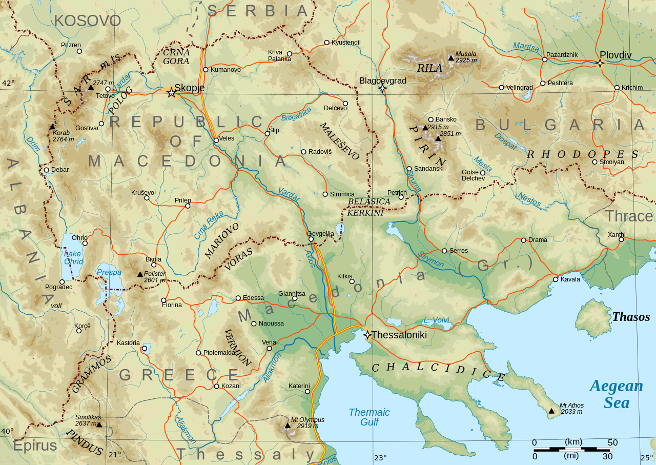
English: Topographical map of Macedonia, i.e. the Republic of North Macedonia, the Greek province of Macedonia, and southwestern Bulgaria. |
| Fecha | |
| Fuente | Trabajo propio |
| Autor | Future Perfect at Sunrise |
| Otras versiones |
Obras derivadas de ésta: Macedonia topography-He.svg This file version has non-horizontal text labels converted to paths, to ensure correct display with renderers that don't do advanced text layout along paths. If you want to modify or translate this map, please work on the basis of File:Macedonia topography (texts).svg, which has the labels preserved as texts (but will only display correctly in Inkscape).
|

.svg)
Made with GRASS GIS and Inkscape software from public-domain geo data (SRTM3, SWBD, VMAP0). See the excellent tutorials by User:Sting at w:fr:Wikipédia:Atelier graphique/Didacticiels cartographiques/Didacticiels pour la cartographie numérique géoréférencée. Relief levels vectorised and exported to SVG; relief shading is embedded bitmap graphics.
Geographical extent: c. 20.5E to 25.3E, 39.8N to 42.4N; map projection: Lambert conformal conic with standard parallels 40 and 42N, standard meridian 23E. Scale approx. 1:1,600,000 at nominal SVG size.
Licencia
| Yo, el titular de los derechos de autor de esta obra, lo libero al dominio público. Esto aplica en todo el mundo. En algunos países esto puede no ser legalmente factible; si ello ocurriese: Concedo a cualquier persona el derecho de usar este trabajo para cualquier propósito, sin ningún tipo de condición al menos que éstas sean requeridas por la ley. |
Historial del archivo
Haz clic sobre una fecha y hora para ver el archivo tal como apareció en ese momento.
| Fecha y hora | Miniatura | Dimensiones | Usuario | Comentario | |
|---|---|---|---|---|---|
| actual | 08:29 31 ene 2009 | | 920 × 652 (4,25 MB) | Future Perfect at Sunrise | some additions and corrections |
| 21:49 23 ene 2009 |  | 920 × 652 (4,01 MB) | Future Perfect at Sunrise | {{Information |Description={{en|1=Topographical map of geographic Macedonia}} |Source=Own work by uploader |Author=Future Perfect at Sunrise |Date=23 January 2009 |Permission= |other_versions= }} <!--{{ImageUpload|full} |
Usos del archivo
No hay páginas que enlacen a este archivo.
Uso global del archivo
Las wikis siguientes utilizan este archivo:
- Uso en ang.wikipedia.org
- Uso en ar.wikipedia.org
- Uso en ca.wikipedia.org
- Uso en el.wikipedia.org
- Uso en en.wikipedia.org
- Uso en fa.wikipedia.org
- Uso en fi.wikipedia.org
- Uso en fr.wikipedia.org
- Uso en he.wikipedia.org
- Uso en id.wikipedia.org
- Uso en it.wikipedia.org
- Uso en ja.wikipedia.org
- Uso en ms.wikipedia.org
- Uso en pl.wikipedia.org
- Uso en sq.wikipedia.org
- Uso en sr.wikipedia.org
- Uso en sw.wikipedia.org
- Uso en trv.wikipedia.org
- Uso en war.wikipedia.org
- Uso en zh-yue.wikipedia.org
- Uso en zh.wikipedia.org