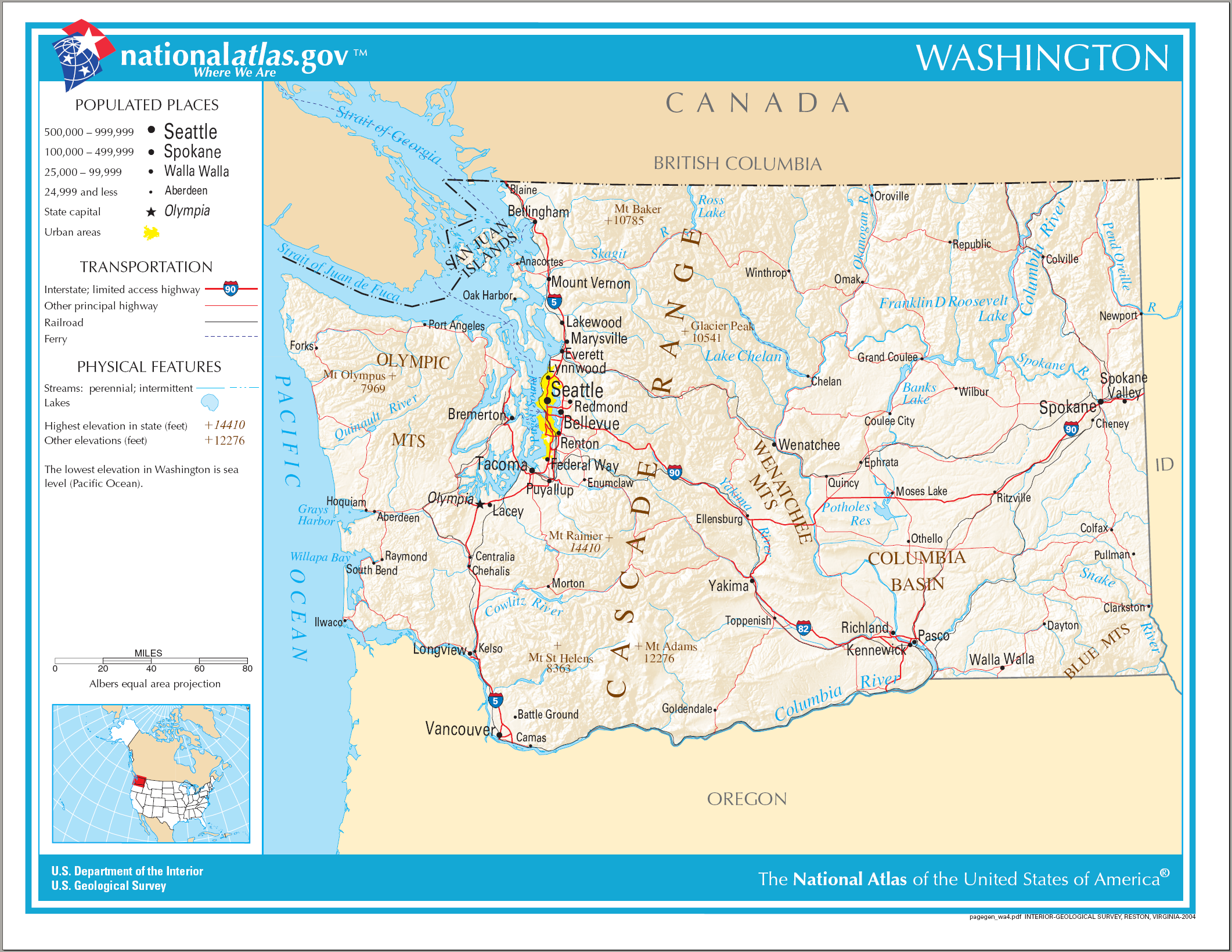
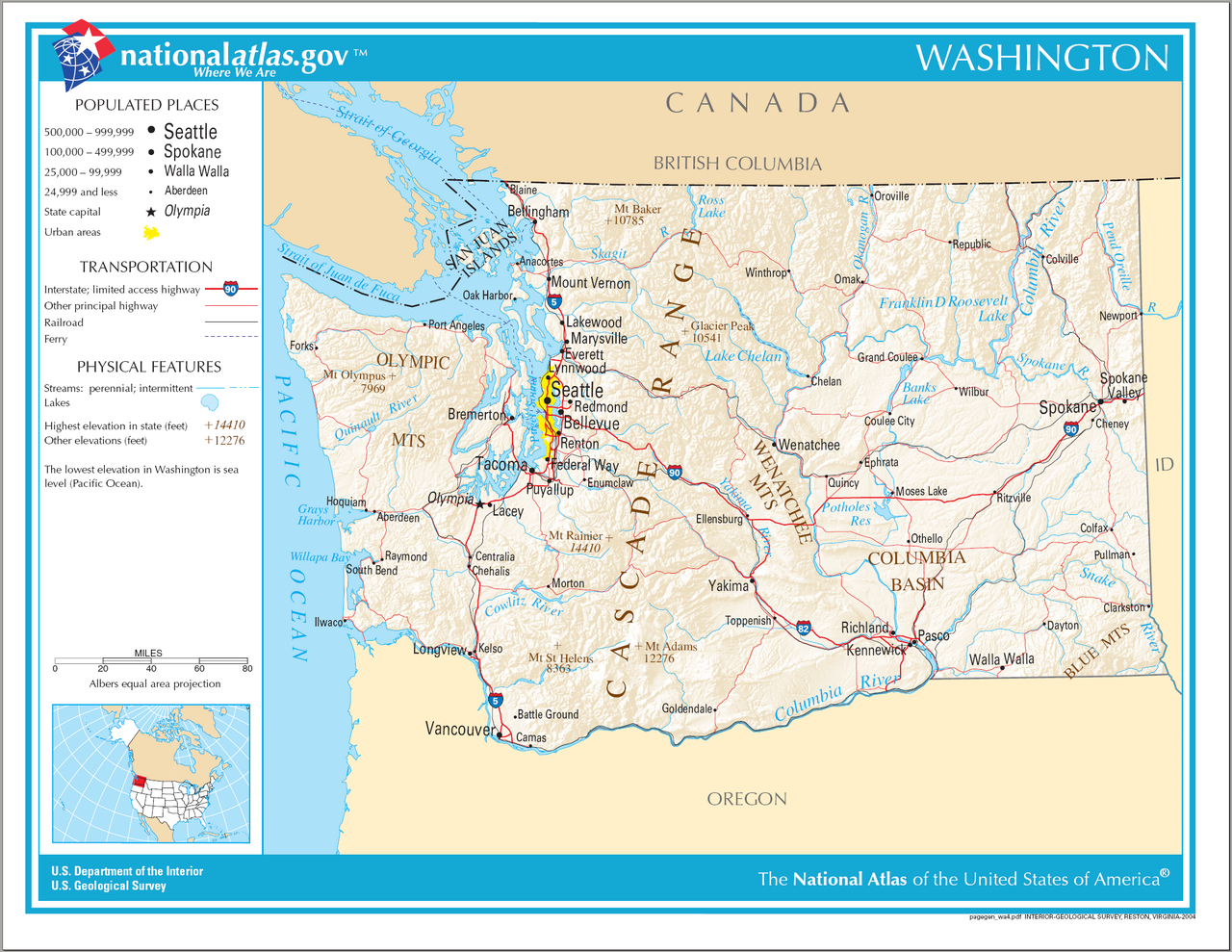
Archivo:Map of Washington NA.png
Tamaño de esta previsualización: 776 × 600 píxeles. Otras resoluciones: 311 × 240 píxeles · 621 × 480 píxeles · 994 × 768 píxeles · 1280 × 989 píxeles · 2122 × 1640 píxeles.
Ver la imagen en su resolución original (2122 × 1640 píxeles; tamaño de archivo: 2,39 MB; tipo MIME: image/png)
Resumen
| Descripción | Map of Washington (state). |
| Fecha | |
| Fuente | National Atlas |
| Autor |
Licencia
This map was obtained from an edition of the National Atlas of the United States. Like almost all works of the U.S. federal government, works from the National Atlas are in the public domain in the United States.
Online access: NationalAtlas.gov | 1970 print edition: Library of Congress, Perry-Castañeda Library
|
Historial del archivo
Haz clic sobre una fecha y hora para ver el archivo tal como apareció en ese momento.
| Fecha y hora | Miniatura | Dimensiones | Usuario | Comentario | |
|---|---|---|---|---|---|
| actual | 10:14 15 ago 2006 | | 2122 × 1640 (2,39 MB) | Huebi~commonswiki | {{Information| |Description=Map of Washington |Source=[http://www.nationalatlas.gov National Atlas] }} Category:Maps of the United States Category:Maps of Washington {{PD-USGov-Atlas}} |
Usos del archivo
La siguiente página usa este archivo:
Uso global del archivo
Las wikis siguientes utilizan este archivo:
- Uso en ca.wikipedia.org
- Uso en de.wikipedia.org
- Uso en en.wikipedia.org
- Uso en hsb.wikipedia.org
- Uso en hu.wikipedia.org
- Uso en ilo.wikipedia.org
- Uso en incubator.wikimedia.org
- Uso en is.wikipedia.org
- Uso en it.wikipedia.org
- Uso en kn.wikipedia.org
- Uso en mr.wikipedia.org
- Uso en ru.wikivoyage.org
- Uso en simple.wikipedia.org
- Uso en si.wikipedia.org
- Uso en uz.wikipedia.org
- Uso en zea.wikipedia.org