Archivo:Serrasalmus distribution map.svg

Ver la imagen en su resolución original ((Imagen SVG, nominalmente 1022 × 1428 pixels, tamaño de archivo: 1,06 MB))
| Descripción |
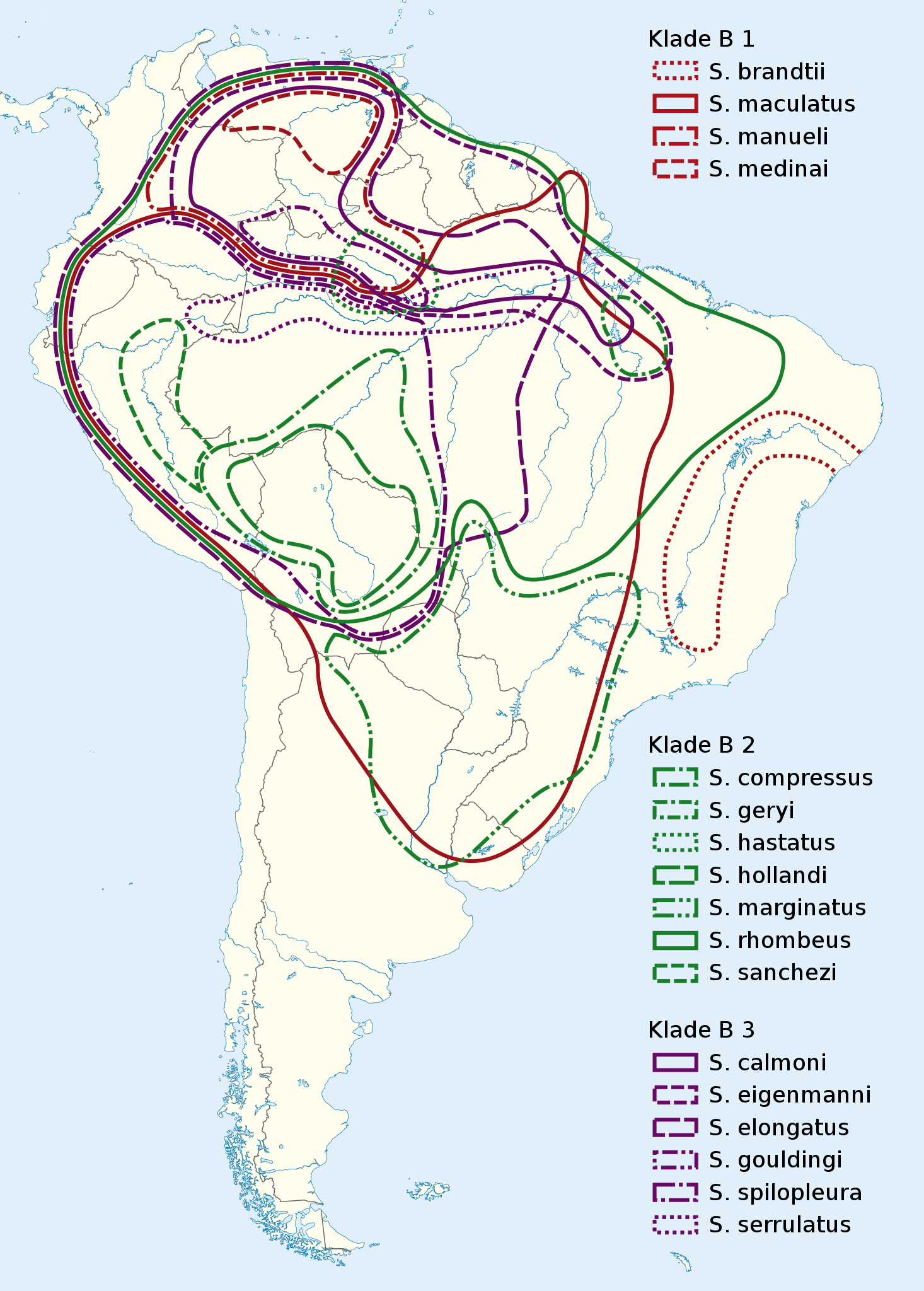
Deutsch: Verbreitungskarte Piranhas
English: Serrasalmus distribution map |
|
| Fecha | (UTC) | |
| Fuente |
|
|
| Autor |
|
|
| Permiso (Reutilización de este archivo) |
Este archivo se encuentra bajo la licencia Creative Commons Reconocimiento-Compartir bajo la misma licencia 3.0 Alemania.
 Este archivo se encuentra bajo la licencia Creative Commons Genérica de Atribución/Compartir-Igual 3.0.
|

Registro original de carga
This image is a derivative work of the following images:
- File:South_America_laea_location_map.svg licensed with Cc-by-sa-3.0, GFDL
- 2010-11-27T12:48:20Z Uwe Dedering 1181x1732 (3103940 Bytes) {{Information |Description={{en|1= Location map of SouthAmerica. * Projection: Lambert azimuthal equal-area projection. * Area of interest: :* N: 25.0° N :* S: -60.0° N :* W: -90.0° E :* E: -30.0° E * Projection center: :
Uploaded with derivativeFX

|
Este mapa se ha hecho o mejorado en el Kartenwerkstatt (taller cartográfico) alemán. También puede proponer mapas para mejorar.
|
Historial del archivo
Haz clic sobre una fecha y hora para ver el archivo tal como apareció en ese momento.
| Fecha y hora | Miniatura | Dimensiones | Usuario | Comentario | |
|---|---|---|---|---|---|
| actual | 21:43 4 mar 2011 | | 1022 × 1428 (1,06 MB) | NordNordWest | {{Information |Description={{de|Verbreitungskarte Piranhas}} {{en|''Serrasalmus'' distribution map}} |Source=*File:South_America_laea_location_map.svg *N. Hubert, F. Duponchelle, J. Nuñez, C. Garcia-Davila, D. P |
Usos del archivo
La siguiente página usa este archivo:
Uso global del archivo
Las wikis siguientes utilizan este archivo:
- Uso en arz.wikipedia.org
- Uso en be.wikipedia.org
- Uso en bg.wikipedia.org
- Uso en ca.wikipedia.org
- Uso en de.wikipedia.org
- Uso en fr.wikipedia.org
- Uso en hsb.wikipedia.org
- Uso en hu.wikipedia.org
- Uso en it.wikipedia.org
- Uso en pl.wikipedia.org
- Uso en pt.wikipedia.org
- Uso en ru.wikipedia.org
- Uso en sv.wikipedia.org
- Uso en th.wikipedia.org
- Uso en uk.wikipedia.org
- Uso en www.wikidata.org
- Uso en zh.wikipedia.org