Archivo:VA-districts-108.JPG
No se dispone de una resolución más alta.
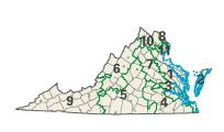
VA-districts-108.JPG (204 × 120 píxeles; tamaño de archivo: 5 kB; tipo MIME: image/jpeg)
| Descripción |
Image adapted from US fed gov't source nationalatlas.gov htttpo<q<- |
|||
| Fuente | National Atlas of the United States | |||
| Autor | United States Department of the Interior | |||
| Permiso (Reutilización de este archivo) |
|
Registro original de carga
Aquí se muestra la página de descripción original. Los siguientes nombres de usuario se refieren a en.wikipedia.
- 2004-02-29 02:16 Seth Ilys 204×120×8 (4792 bytes) {{msg:PD}} Image adapted from US fed gov't source nationalatlas.gov
Historial del archivo
Haz clic sobre una fecha y hora para ver el archivo tal como apareció en ese momento.
| Fecha y hora | Miniatura | Dimensiones | Usuario | Comentario | |
|---|---|---|---|---|---|
| actual | 17:33 4 dic 2006 | | 204 × 120 (5 kB) | Shyam | {{Information |Description=Image adapted from US fed gov't source nationalatlas.gov htttpo<q<- |Source=Originally from [http://en.wikipedia.org en.wikipedia]; description page is/was [http://en.wikipedia.org/w/index.php?title=Image%3AVA-districts-108.JPG |
Usos del archivo
La siguiente página usa este archivo:
Uso global del archivo
Las wikis siguientes utilizan este archivo:
- Uso en ca.wikipedia.org
- Uso en de.wikipedia.org
- Uso en en.wikipedia.org
- Uso en fr.wikipedia.org
- Uso en nl.wikipedia.org