Archivo:Zugspitze Airview 01.jpg

Ver la imagen en su resolución original (2814 × 2111 píxeles; tamaño de archivo: 4,12 MB; tipo MIME: image/jpeg)
Resumen
| Descripción |
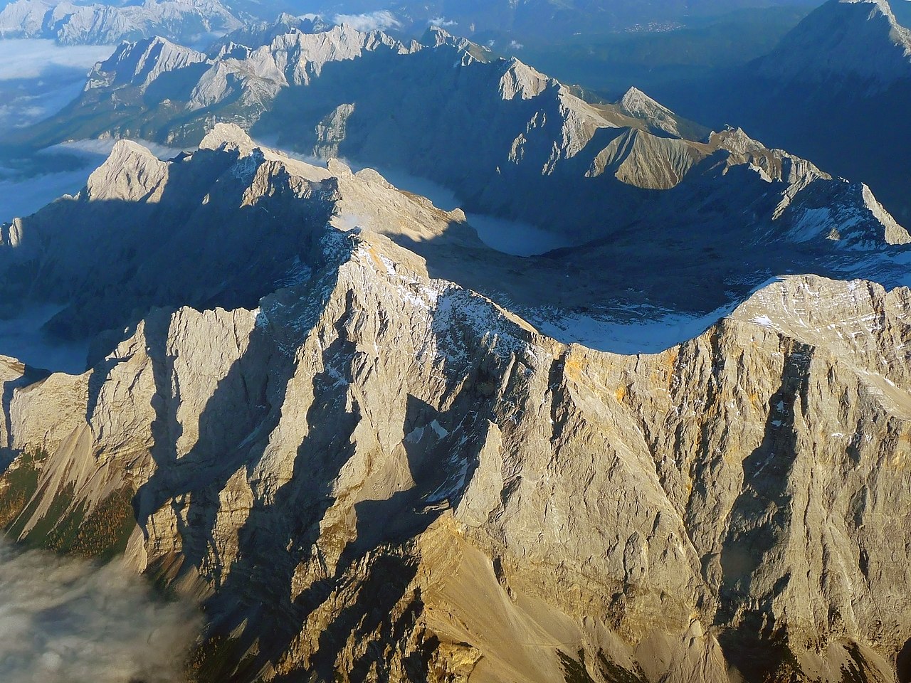
English: The "Zugspitze", the highest mountain in Germany as seen from an aircraft. View from West, with mountains in Wetterstein around and valley Reintal with fog or clouds from above.
Deutsch: Die "Zugspitze", der höchste Berg Deutschlands aus einem Flugzeug gesehen. Der Hauptgipfel des Wettersteingebirges ist umgeben von tieferliegenden Graten wie dem Jubiläumsgrat, dem Schneefernerkopf rechts neben dem Gipfel in der Mitte, mit dem Zugspitzplatt und dem steil abfallenden Reintal dahinter, die beide bereits im Schatten des späten Nachmittags liegen. Oktober mit Sonne auf dem Gipfel. |
| Fecha | |
| Fuente | Trabajo propio |
| Autor | Africaspotter |
| Posición de la cámara | | Ubicación de esta y otras imágenes en: OpenStreetMap |
|---|
Licencia
- Eres libre:
- de compartir – de copiar, distribuir y transmitir el trabajo
- de remezclar – de adaptar el trabajo
- Bajo las siguientes condiciones:
- atribución – Debes otorgar el crédito correspondiente, proporcionar un enlace a la licencia e indicar si realizaste algún cambio. Puedes hacerlo de cualquier manera razonable pero no de manera que sugiera que el licenciante te respalda a ti o al uso que hagas del trabajo.
- compartir igual – En caso de mezclar, transformar o modificar este trabajo, deberás distribuir el trabajo resultante bajo la misma licencia o una compatible como el original.
1. Online-Medien:
2. Print-Medien:
Ich bitte um Zusendung eines Belegexemplares bzw. der URL, wo das Foto benutzt wird. Bitte schreiben Sie eine E-Mail, wenn Sie meine Adresse für die Zusendung eines Belegexemplares benötigen oder weitergehende Fragen zur Lizenznutzung haben. Eine Auswahl meiner Fotos finden Sie auch auf www.felixgottwald.net. |
1. Online media:
2. Print media:
Please send me a specimen copy or the URL of the website where the image is used. Please write an email, if you need my postal address for sending a specimen copy or have further questions regarding the terms of licence. You may also find a selection of my photos at www.felixgottwald.net. |
| Annotations | This image is annotated: View the annotations at Commons |
Historial del archivo
Haz clic sobre una fecha y hora para ver el archivo tal como apareció en ese momento.
| Fecha y hora | Miniatura | Dimensiones | Usuario | Comentario | |
|---|---|---|---|---|---|
| actual | 19:00 13 oct 2010 | | 2814 × 2111 (4,12 MB) | Africaspotter | {{Information |Description={{en|1=The "Zugspitze", the highest mountain in Germany as seen from an aircraft.}} {{de|1=Die "Zugspitze", der höchste Berg Deutschlands aus einem Flugzeug gesehen.}} |Source={{own}} |Author=[[User:Africaspotter|Africaspotter] |
Usos del archivo
No hay páginas que enlacen a este archivo.
Uso global del archivo
Las wikis siguientes utilizan este archivo:
- Uso en be.wikipedia.org
- Uso en bg.wikipedia.org
- Uso en bs.wikipedia.org
- Uso en cs.wikipedia.org
- Uso en de.wikipedia.org
- Uso en dsb.wikipedia.org
- Uso en en.wikipedia.org
- Uso en eo.wikipedia.org
- Uso en et.wikipedia.org
- Uso en eu.wikipedia.org
- Uso en fi.wikipedia.org
- Uso en fr.wikipedia.org
- Uso en gl.wikipedia.org
- Uso en he.wikipedia.org
- Uso en hsb.wikipedia.org
- Uso en hu.wikipedia.org
- Uso en id.wikipedia.org
- Uso en is.wikipedia.org
- Uso en it.wikipedia.org
- Uso en ja.wikipedia.org
- Uso en lt.wikipedia.org
- Uso en mr.wikipedia.org
- Uso en ms.wikipedia.org
- Uso en nl.wikipedia.org
- Uso en no.wikipedia.org
- Uso en pl.wikipedia.org
- Uso en pnb.wikipedia.org
- Uso en pt.wikipedia.org
- Uso en ro.wikipedia.org
- Uso en simple.wikipedia.org
- Uso en sk.wikipedia.org
- Uso en sv.wikipedia.org
- Uso en tr.wikipedia.org
- Uso en uk.wikipedia.org
- Uso en vi.wikipedia.org
- Uso en zh.wikipedia.org