Archivo:Billings Metropolitan Area.png
No se dispone de una resolución más alta.
Billings_Metropolitan_Area.png (539 × 313 píxeles; tamaño de archivo: 24 kB; tipo MIME: image/png)
| Descripción |
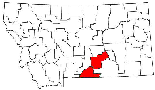
English: Locator map of the Billings Metropolitan Statistical Area in the southern part of the U.S. state of Montana. |
||
| Fecha | |||
| Fuente | Modified from this United States Census Bureau file, based on this Census definitions list. | ||
| Autor | Nyttend | ||
| Permiso (Reutilización de este archivo) |
US Government work is public domain, and my work is
|
Historial del archivo
Haz clic sobre una fecha y hora para ver el archivo tal como apareció en ese momento.
| Fecha y hora | Miniatura | Dimensiones | Usuario | Comentario | |
|---|---|---|---|---|---|
| actual | 03:08 18 abr 2011 | | 539 × 313 (24 kB) | Nyttend | See the second link in the "source" line: it's just two counties, not seven |
| 02:51 18 abr 2011 |  | 539 × 313 (24 kB) | Wolfdog406 | Added two more counties. | |
| 01:46 18 abr 2011 |  | 539 × 313 (24 kB) | Wolfdog406 | Added more counties to the Billings Metro Area. | |
| 03:35 27 jul 2008 |  | 539 × 313 (24 kB) | Nyttend | {{Information |Description=Locator map of the {{w|Billings Metropolitan Area|Billings Metropolitan Statistical Area}} in the southern part of the {{w|U.S. state}} of {{w|Montana}}. |Source=Modified from [http://www2.census.gov/geo/maps/general_ref/cousub_ |
Usos del archivo
La siguiente página usa este archivo: