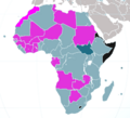
Archivo:CAN 2012 Qualified Nations.png
CAN_2012_Qualified_Nations.png (380 × 345 píxeles; tamaño de archivo: 37 kB; tipo MIME: image/png)
Historial del archivo
Haz clic sobre una fecha y hora para ver el archivo tal como apareció en ese momento.
| Fecha y hora | Miniatura | Dimensiones | Usuario | Comentario | |
|---|---|---|---|---|---|
| actual | 14:42 1 feb 2012 |  | 380 × 345 (37 kB) | Pacific kiribati | Keep cool buddy. Please do not overreact. You cannot be right against the vast majority of maps excluding western sahara from morocco. If you don't agree then, as suggested, upload your own version of file and clearly specify that western sahara is under |
| 14:35 1 feb 2012 |  | 380 × 345 (39 kB) | Karakizi | I'm neutral and wise, I've shown you all the arguments, stop your defamation against me, I'll not allow that you spread your propaganda through wikipedia.. | |
| 14:28 1 feb 2012 |  | 380 × 345 (37 kB) | Pacific kiribati | Please, stop changing the map according to your personal views. Be neutral and wise or I will have to make an official request to an administrator about this. | |
| 14:26 1 feb 2012 |  | 380 × 345 (39 kB) | Karakizi | Once again you're not answering but telling a non-sense things | |
| 13:10 1 feb 2012 |  | 380 × 345 (37 kB) | Pacific kiribati | Once again, and as you seem to agree with, this is not a political court. Leave politics aside and stick to facts and neutral maps. Original map is the correct one. Stop edition war , please. This file will end up being locked out. | |
| 13:02 1 feb 2012 |  | 380 × 345 (39 kB) | Karakizi | How many times I've to repeat what I've already said, western saharan football teams plays in moroccan league and are considered moroccans, FIFA has not excluded them from international competitions, moreover, this territory belongs to morocco, in th web | |
| 12:11 1 feb 2012 |  | 380 × 345 (37 kB) | Pacific kiribati | Have a look on any map which is not issued by morocco, western sahara is NOT part of morrocco. Stick to this fact, please. You are turning it politically. Again, sports only sports. Thanks. | |
| 11:31 1 feb 2012 |  | 380 × 345 (39 kB) | Karakizi | this is a football map not a political one, western sahara football teams plays in moroccan league, moreover your map show western sahara as an independent country which is extremely FALSE | |
| 10:52 1 feb 2012 |  | 380 × 345 (37 kB) | Pacific kiribati | Western Sahara does NOT appear as being a part of morocco on nearly all maps of africa. Original map is then correct. | |
| 10:47 1 feb 2012 |  | 380 × 345 (39 kB) | Karakizi | Please Stop mixing up sport with politics, Western Saharan football teams play in moroccan League, see this in Wikipedia "JS Massira", moreover Western sahara is not a sovereign country or a no man's land |
Usos del archivo
La siguiente página usa este archivo:
Uso global del archivo
Las wikis siguientes utilizan este archivo:
- Uso en cs.wikipedia.org
- Uso en pt.wikipedia.org
