Archivo:Gpnf vicinity.png

Tamaño de esta previsualización: 463 × 599 píxeles. Otras resoluciones: 185 × 240 píxeles · 371 × 480 píxeles · 593 × 768 píxeles · 1275 × 1650 píxeles.
Ver la imagen en su resolución original (1275 × 1650 píxeles; tamaño de archivo: 407 kB; tipo MIME: image/png)
Resumen
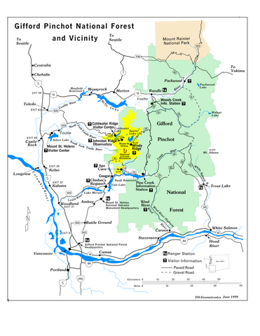
Map retrieved from U.S. Government website, [1] in pdf format and converted to png.
Licencia
This image is a work of the Forest Service of the United States Department of Agriculture. As a work of the U.S. federal government, the image is in the public domain.
|
Historial del archivo
Haz clic sobre una fecha y hora para ver el archivo tal como apareció en ese momento.
| Fecha y hora | Miniatura | Dimensiones | Usuario | Comentario | |
|---|---|---|---|---|---|
| actual | 05:44 2 ene 2006 | | 1275 × 1650 (407 kB) | Wsiegmund | Map retrieved from U.S. Government website, [http://www.fs.fed.us/gpnf/sitemap/maps.shtml] in pdf format and converted to png. |
Usos del archivo
La siguiente página usa este archivo:
Uso global del archivo
Las wikis siguientes utilizan este archivo:
- Uso en de.wikipedia.org
- Uso en fr.wikipedia.org