Archivo:Pike Nat Forest vicinity map.jpg
No se dispone de una resolución más alta.
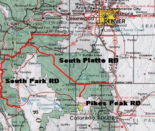
Pike_Nat_Forest_vicinity_map.jpg (507 × 430 píxeles; tamaño de archivo: 102 kB; tipo MIME: image/jpeg)
Resumen
| Descripción |
English: Map of Pike National Forest (green areas).
|
| Fecha | Fecha desconocida |
| Fuente | http://www.fs.fed.us/r2/psicc/maps/pike_vicinity.jpg |
| Autor | USDA |
Licencia
This image is a work of the Forest Service of the United States Department of Agriculture. As a work of the U.S. federal government, the image is in the public domain.
|
Historial del archivo
Haz clic sobre una fecha y hora para ver el archivo tal como apareció en ese momento.
| Fecha y hora | Miniatura | Dimensiones | Usuario | Comentario | |
|---|---|---|---|---|---|
| actual | 21:55 23 jul 2007 | | 507 × 430 (102 kB) | Ken g6 | A map of the Pike National Forest. Sourced from [http://www.fs.fed.us/r2/psicc/maps/pike_vicinity.jpg this image], the picture was found on [http://www.fs.fed.us/r2/psicc/maps/pike.shtml this U.S.D.A. Forest Service web site]. |
Usos del archivo
La siguiente página usa este archivo:
Uso global del archivo
Las wikis siguientes utilizan este archivo:
- Uso en de.wikipedia.org
- Uso en en.wikipedia.org
- Uso en fa.wikipedia.org
- Uso en www.wikidata.org