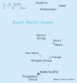
Archivo:Tonga sm04.gif
Tonga_sm04.gif (359 × 386 píxeles; tamaño de archivo: 6 kB; tipo MIME: image/gif)
Historial del archivo
Haz clic sobre una fecha y hora para ver el archivo tal como apareció en ese momento.
| Fecha y hora | Miniatura | Dimensiones | Usuario | Comentario | |
|---|---|---|---|---|---|
| actual | 05:18 13 feb 2022 |  | 359 × 386 (6 kB) | Lojwe | Cropped 1 % horizontally, 1 % vertically using CropTool with precise mode. |
| 22:38 27 nov 2006 |  | 364 × 391 (7 kB) | Electionworld | {{ew|en|Tom Radulovich}} {{PD-USGov-CIA}} Category:Maps of Tonga |
Usos del archivo
La siguiente página usa este archivo:
Uso global del archivo
Las wikis siguientes utilizan este archivo:
- Uso en be-tarask.wikipedia.org
- Uso en cs.wikipedia.org
- Uso en cy.wikipedia.org
- Uso en de.wikipedia.org
- Uso en en.wikipedia.org
- Uso en fa.wikipedia.org
- Uso en fi.wikipedia.org
- Uso en fr.wikipedia.org
- Uso en gl.wikipedia.org
- Uso en id.wikipedia.org
- Uso en incubator.wikimedia.org
- Uso en io.wikipedia.org
- Uso en it.wikipedia.org
- Uso en ja.wikipedia.org
- Uso en jv.wikipedia.org
- Uso en ka.wikipedia.org
- Uso en ko.wikipedia.org
- Uso en ml.wikipedia.org
- Uso en mrj.wikipedia.org
- Uso en mr.wikipedia.org
- Uso en no.wikipedia.org
- Uso en pt.wikipedia.org
- Uso en ro.wikipedia.org
- Uso en ru.wikipedia.org
- Uso en sd.wikipedia.org
- Uso en simple.wikipedia.org
- Uso en sv.wikipedia.org
Ver más uso global de este archivo.


