Archivo:Wallowa-Whitman National Forest map.gif

Tamaño de esta previsualización: 583 × 600 píxeles. Otras resoluciones: 233 × 240 píxeles · 600 × 617 píxeles.
Ver la imagen en su resolución original (600 × 617 píxeles; tamaño de archivo: 38 kB; tipo MIME: image/gif)
Resumen
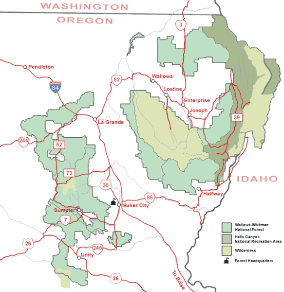
| Descripción | Map of the Wallowa-Whitman National Forest in northeastern Oregon. |
| Fuente | U.S. Forest Service |
| Autor | U.S. Forest Service |
| Permiso (Reutilización de este archivo) |
Public domain, created by federal government |
Licencia
This image is a work of the Forest Service of the United States Department of Agriculture. As a work of the U.S. federal government, the image is in the public domain.
|
Historial del archivo
Haz clic sobre una fecha y hora para ver el archivo tal como apareció en ese momento.
| Fecha y hora | Miniatura | Dimensiones | Usuario | Comentario | |
|---|---|---|---|---|---|
| actual | 09:36 14 may 2008 | | 600 × 617 (38 kB) | Northwest-historian | {{Information |Description=Map of the Wallowa-Whitman National Forest in northeastern Oregon. |Source=[http://www.fs.fed.us/r6/w-w/recreation/recreation-map.shtml U.S. Forest Service] |Author=U.S. Forest Service |Permission=Public domain, created by feder |
Usos del archivo
La siguiente página usa este archivo:
Uso global del archivo
Las wikis siguientes utilizan este archivo:
- Uso en ca.wikipedia.org
- Uso en en.wikipedia.org
- Uso en fa.wikipedia.org
- Uso en ja.wikipedia.org
- Uso en ro.wikipedia.org
- Uso en sh.wikipedia.org
- Uso en ur.wikipedia.org
- Uso en zh.wikipedia.org