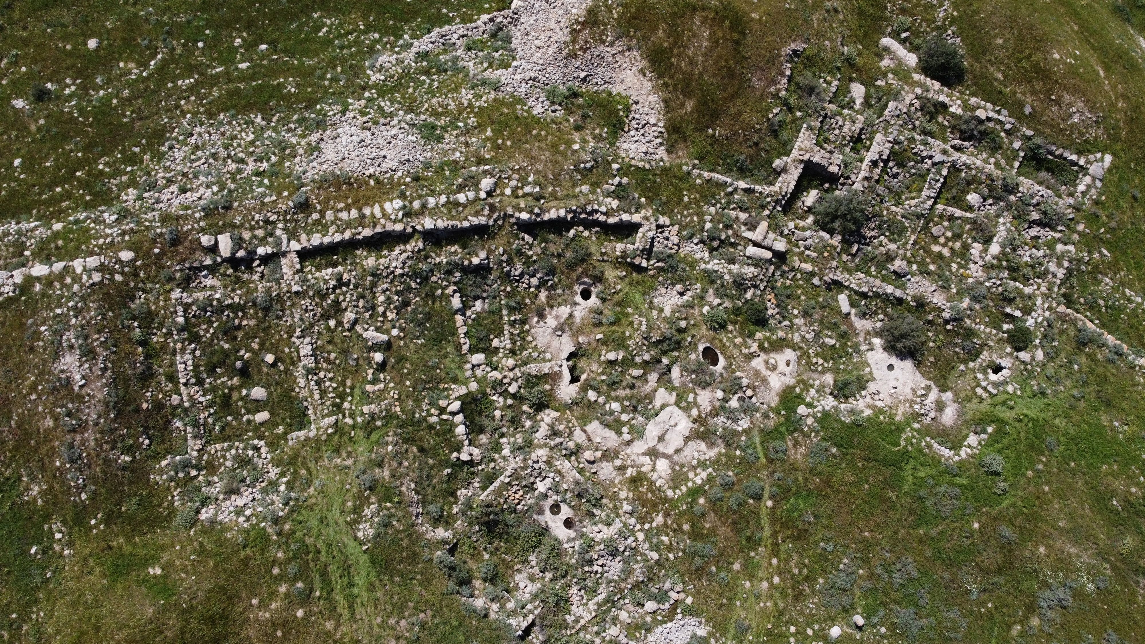
Tell Beit Mirsim
Tell Beit Mirsim (en hebreo: תל בית מירסים, en árabe: تل بیت میرسیم) es un yacimiento arqueológico en Israel ubicado en la frontera entre Sefelá y Hebrón. Está situado en la región oriental de Laquis, a unos 20 kilómetros al suroeste de Hebrón y a unos 13 kilómetros al sureste de Laquis.
| Tell Beit Mirsim | ||
|---|---|---|
| תל בית מירסים | ||
 | ||
| Ubicación | ||
| País |
| |
| Municipio | Sefelá | |
| Coordenadas | 31°27′00″N 34°55′00″E / 31.45, 34.91666667 | |
| Historia | ||
| Tipo | Tell | |
| Descubrimiento y hallazgos | ||
| Excavaciones | 1926, 1928, 1930 y 1932 | |
| Arqueólogos | William Foxwell Albright | |
| Mapa de localización | ||
|
Ubicación en Israel | ||


Historia editar
El sitio fue explorado en 1926, 1928, 1930 y 1932 por William Foxwell Albright,[1] a veces acompañado por Nelson Glueck.[2]
Se trata de un ejemplo característico de ciudad del reino de Judá siguiendo el ejemplo de Beit Shemesh, (Tell en-Nasbeh), Khirbet Qeiyafa y Beerseva: en todos estos yacimientos se construyó un muro de casamatas y las casas de la ciudad cercana incorporaron las casamatas como una de las estancias de la vivienda. Este modelo no se conoce en ningún yacimiento cananeo, filisteo o del Reino de Israel. Durante las excavaciones, Albright descubrió dos fragmentos de asas de vaso con la inscripción hebrea: «l˒lyqm n˓r ywkn»" que significa «a Eliakim siervo de Yokin».[3]
Albright identifica el lugar con la ciudad bíblica de Debir, pero esta identificación no es aceptada por la comunidad arqueológica, considerando Rabud la ubicación más probable.[4]
Referencias editar
- ↑ Albright, William Foxwel (octubre de 1932). «The Fourth Joint Campaign of Excavation at Tell Beit Mirsim». Bulletin of the American Schools of Oriental Research (en inglés) (47): 3-17.
- ↑ Gran-Aymerich]], Ève (2007). Les chercheurs de passé (en francés). Éditions du CNRS. pp. 832-833.
- ↑ Igor Kreimerman; Pnina Torn Broers; Itamar Weissbein (abril de 2022). «Back to Tell Beit Mirsim: Preliminary results of the Renewed Excavations / בחזרה לתל בית מרסים: תוצאות ראשונות של החפירות המחודשות באתר» (en hebreo). Consultado el 10 de diciembre de 2023.
- ↑ Bryce, Trevor (2009). The Routledge Handbook of the Peoples and Places of Ancient Western Asia: From the Early Bronze Age to the Fall of the Persian Empire (en inglés). Taylor & Francis. p. 588.
Bibliografía editar
- Conder, Claude Reignier; Kitchener, Herbert r (1883). [1] The Survey of Western Palestine: Memoirs of the Topography, Orography, Hydrography, and Archaeology] (en inglés) 3. Londres: Committee of the Palestine Exploration Fund. p. 279. Consultado el 7 de diciembre de 2023.
- Ganor, Sa‘ar; Weiss, Shifra; Aladjem, Emil (12 de agosto de 2019). Tell Beit Mirsim (South) (en inglés) (131). Hadashot Arkheologiyot – Excavations and Surveys in Israel. Consultado el 7 de diciembre de 2023.
- Gedy, Miki Ein; Golan, Karni (14 de enero de 2007). Tell Beit Mirsim (en inglés) (119). Hadashot Arkheologiyot – Excavations and Surveys in Israel. Consultado el 7 de diciembre de 2023.
- Guérin, Victor (1881). «Description Géographique Historique et Archéologique de la Palestine». En L'Imprimerie Nationale, ed. The Survey of Western Palestine: Arabic and English Name Lists Collected During the Survey by Lieutenants Conder and Kitchener, R. E. Transliterated and Explained by E.H. Palmer (en francés). 1: Judee, pt. 2. Paris: Committee of the Palestine Exploration Fund. p. 379. Consultado el 7 de diciembre de 2023.
Enlaces externos editar
- Esta obra contiene una traducción total derivada de «Tell Beit Mirsim» de Wikipedia en francés, concretamente de esta versión, publicada por sus editores bajo la Licencia de documentación libre de GNU y la Licencia Creative Commons Atribución-CompartirIgual 4.0 Internacional.
