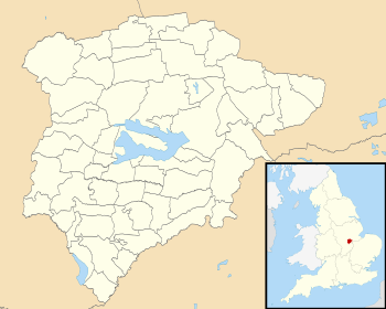
 Mapa de Rutland y sus parroquias.
Rutland es un condado ceremonial y una autoridad unitaria de Inglaterra. A efectos de gobierno local está dividido en entidades menores conocidas como parroquias civiles, listadas a continuación junto con la superficie que ocupan en km² y la población recogida en el censo de 2001:[1][2]
| Parroquia
|
Superficie
|
Población
|
| Ashwell |
7,42 |
290
|
| Ayston |
— |
46
|
| Barleythorpe |
4,02 |
178
|
| Barrow |
— |
67
|
| Barrowden |
7,32 |
420
|
| Beaumont Chase |
— |
0
|
| Belton-in-Rutland |
4,14 |
335
|
| Bisbrooke |
4,62 |
211
|
| Braunston-in-Rutland |
— |
392
|
| Brooke |
— |
67
|
| Burley |
— |
577
|
| Caldecott |
— |
256
|
| Clipsham |
— |
120
|
| Cottesmore |
— |
2332
|
| Edith Weston |
— |
1042
|
| Egleton |
— |
79
|
| Empingham |
18,3 |
815
|
| Essendine |
5,98 |
368
|
| Exton |
— |
600
|
| Glaston |
4,75 |
185
|
| Great Casterton |
— |
434
|
| Greetham |
12,45 |
609
|
| Gunthorpe |
— |
19
|
| Hambleton |
— |
140
|
| Horn |
— |
9
|
| Ketton |
13,5 |
1666
|
| Langham |
11,82 |
1042
|
| Leighfield |
— |
10
|
| Little Casterton |
4,95 |
148
|
| Lyddington |
8,61 |
397
|
| Lyndon |
— |
80
|
| Manton |
— |
364
|
| Market Overton |
— |
494
|
| Martinsthorpe |
— |
0
|
| Morcott |
5,52 |
329
|
| Normanton |
— |
26
|
| North Luffenham |
8,23 |
704
|
| Oakham |
9,09 |
9975
|
| Pickworth |
— |
81
|
| Pilton |
— |
39
|
| Preston |
4,88 |
179
|
| Ridlington |
— |
202
|
| Ryhall |
10,83 |
1644
|
| Seaton |
— |
178
|
| South Luffenham |
5,84 |
432
|
| Stoke Dry |
— |
35
|
| Stretton |
— |
770
|
| Teigh |
— |
48
|
| Thistleton |
— |
99
|
| Thorpe by Water |
— |
56
|
| Tickencote |
— |
67
|
| Tinwell |
7,23 |
209
|
| Tixover |
3,42 |
174
|
| Uppingham |
— |
3947
|
| Wardley |
— |
32
|
| Whissendine |
16,3 |
1189
|
| Whitwell |
— |
41
|
| Wing |
4,52 |
315
|