Archivo:Asylum Township.jpg
Tamaño de esta previsualización: 800 × 494 píxeles. Otras resoluciones: 320 × 197 píxeles · 640 × 395 píxeles · 1024 × 632 píxeles · 1280 × 790 píxeles · 2560 × 1579 píxeles · 3717 × 2293 píxeles.
Ver la imagen en su resolución original (3717 × 2293 píxeles; tamaño de archivo: 6,88 MB; tipo MIME: image/jpeg)
| Descripción |
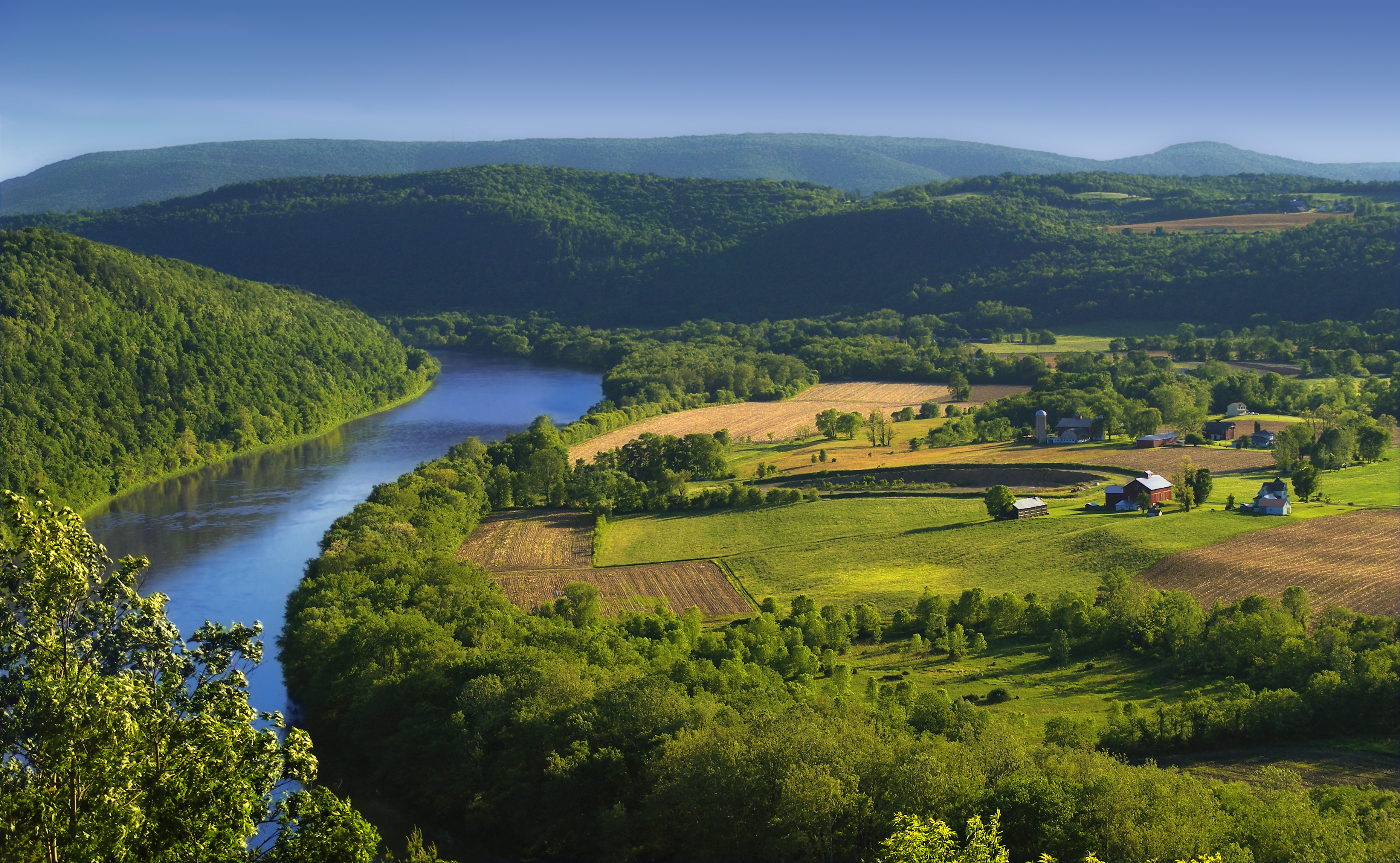
English: The Susquehanna River, Asylum Township, Bradford County, as seen from the Marie Antoinette Lookout off of US Route 6 near Wyalusing in Pennsylvania. Visible from here is the French Azilum Historic Site, where some Revolution-fleeing French aristocrats settled in 1793. It was said that Marie Antoinette planned to settle in a house across the river from the lookout which was allegedly built for her. The marker reads: A settlement of French royalists, who fled the French Revolution in 1793, was established in the valley directly opposite this marker. It was laid out and settled under the direction of Viscount de Noailles and Marquis Antoine Omer Talon. It was hoped that Queen Marie Antoinette might here find safety. Marie Antoinette Lookout, Route 6, Wyalusing, PA. |
||
| Fecha | |||
| Fuente | https://www.flickr.com/photos/nicholas_t/3594274494/ | ||
| Autor | Nicholas A. Tonelli from Northeast Pennsylvania, USA | ||
| Permiso (Reutilización de este archivo) |
|
| Posición de la cámara | | Ubicación de esta y otras imágenes en: OpenStreetMap |
|---|
Licencia
Este archivo está disponible bajo la licencia Creative Commons Atribución 2.0 Genérica.
- Eres libre:
- de compartir – de copiar, distribuir y transmitir el trabajo
- de remezclar – de adaptar el trabajo
- Bajo las siguientes condiciones:
- atribución – Debes otorgar el crédito correspondiente, proporcionar un enlace a la licencia e indicar si realizaste algún cambio. Puedes hacerlo de cualquier manera razonable pero no de manera que sugiera que el licenciante te respalda a ti o al uso que hagas del trabajo.
Historial del archivo
Haz clic sobre una fecha y hora para ver el archivo tal como apareció en ese momento.
| Fecha y hora | Miniatura | Dimensiones | Usuario | Comentario | |
|---|---|---|---|---|---|
| actual | 00:49 6 jun 2009 | | 3717 × 2293 (6,88 MB) | Flickr upload bot | Uploaded from http://flickr.com/photo/14922165@N00/3594274494 using Flickr upload bot |
Usos del archivo
La siguiente página usa este archivo:
Uso global del archivo
Las wikis siguientes utilizan este archivo:
- Uso en ar.wikipedia.org
- Uso en azb.wikipedia.org
- Uso en cy.wikipedia.org
- Uso en da.wikipedia.org
- Uso en en.wikipedia.org
- Uso en eo.wikipedia.org
- Uso en fi.wikipedia.org
- Uso en fr.wikipedia.org
- Uso en fy.wikipedia.org
- Uso en hu.wikipedia.org
- Uso en id.wikipedia.org
- Uso en it.wikipedia.org
- Uso en ko.wikipedia.org
- Uso en ml.wikipedia.org
- Uso en ms.wikipedia.org
- Uso en new.wikipedia.org
- Uso en sl.wikipedia.org
- Uso en sr.wikipedia.org
- Uso en sv.wikipedia.org
- Uso en th.wikipedia.org
- Uso en tl.wikipedia.org
- Uso en tr.wikipedia.org
- Uso en uk.wikipedia.org
- Uso en vi.wikipedia.org
- Uso en www.wikidata.org
- Uso en xmf.wikipedia.org
- Uso en zh.wikipedia.org