Archivo:Caithness UK location map.svg

Tamaño de esta previsualización PNG del archivo SVG: 519 × 599 píxeles. Otras resoluciones: 208 × 240 píxeles · 416 × 480 píxeles · 665 × 768 píxeles · 887 × 1024 píxeles · 1773 × 2048 píxeles · 1233 × 1424 píxeles.
Ver la imagen en su resolución original ((Imagen SVG, nominalmente 1233 × 1424 pixels, tamaño de archivo: 1,29 MB))
| Descripción |
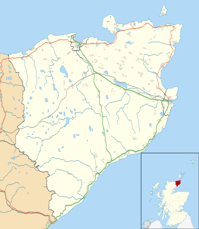
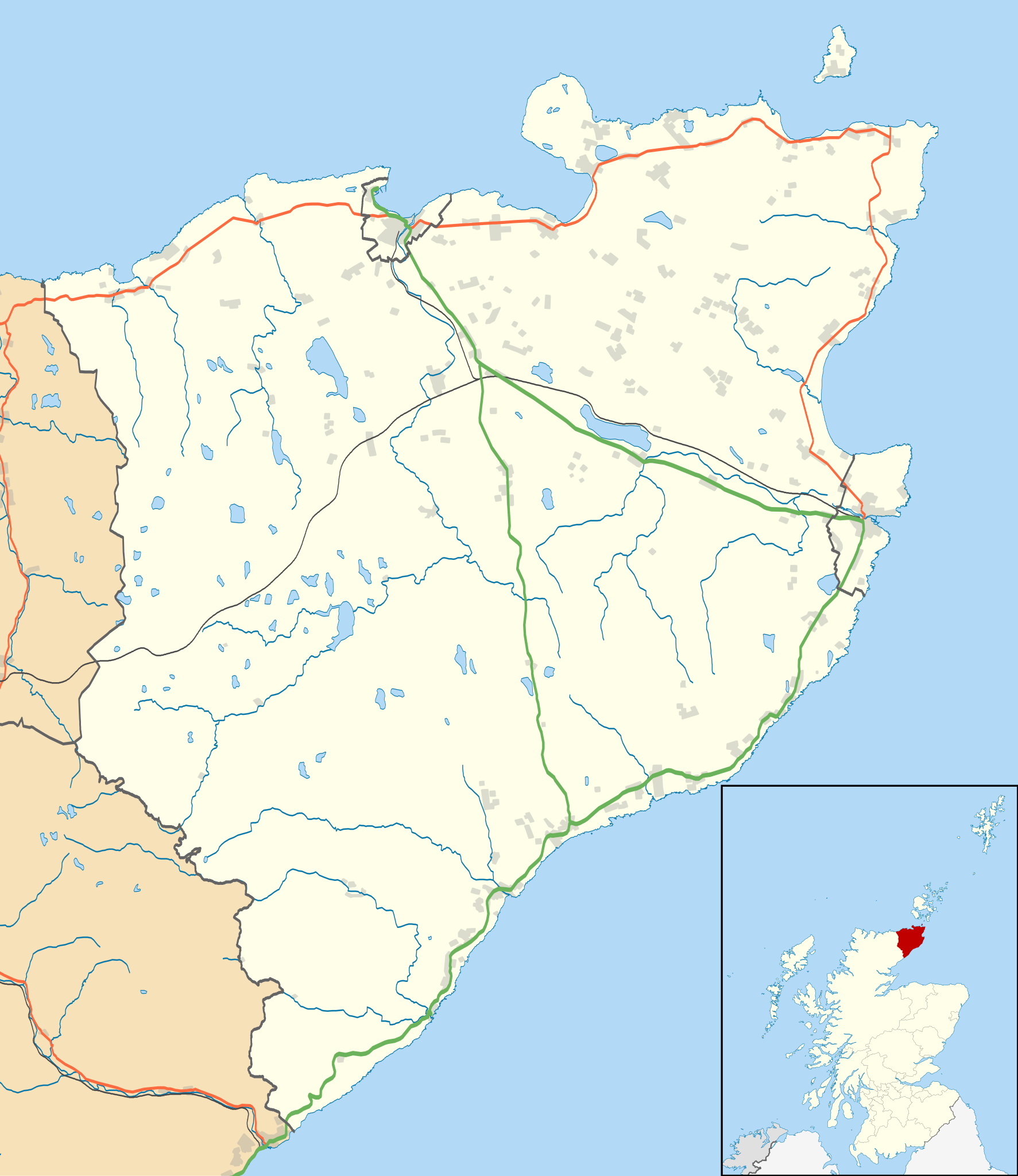
Blank map of the Caithness ward management area, UK in 2011, with the following information shown:
Equirectangular map projection on WGS 84 datum, with N/S stretched 180% Geographic limits:
|
| Fecha | |
| Fuente |
|
| Autor | Nilfanion, created using Ordnance Survey data |
| Permiso (Reutilización de este archivo) |
Este archivo se encuentra bajo la licencia Creative Commons Genérica de Atribución/Compartir-Igual 3.0. Atribución: Contains Ordnance Survey data © Crown copyright and database right
|
| Otras versiones | File:Caithness UK blank map.svg - Blank map |
Historial del archivo
Haz clic sobre una fecha y hora para ver el archivo tal como apareció en ese momento.
| Fecha y hora | Miniatura | Dimensiones | Usuario | Comentario | |
|---|---|---|---|---|---|
| actual | 11:11 10 feb 2011 | | 1233 × 1424 (1,29 MB) | Nilfanion | {{Information |Description=Blank map of the Caithness ward management area, UK in 2011, with the following information shown: *Ward boundaries *Coastline, lakes and rivers *Roads and railways *Urban areas Equirectangular map projection on |
Usos del archivo
Las siguientes páginas usan este archivo:
Uso global del archivo
Las wikis siguientes utilizan este archivo:
- Uso en ar.wikipedia.org
- Uso en ceb.wikipedia.org
- Uso en en.wikipedia.org
- Castle of Mey
- Thurso
- Halkirk
- Latheronwheel
- Castletown, Highland
- Haster
- Dunnet
- Latheron
- Caithness General Hospital
- Georgemas
- Reay
- Watten, Highland
- Altnabreac
- Achreamie
- Ackergill
- Skarfskerry
- Lybster
- Nybster
- Fresgoe
- Dunbeath
- Scrabster
- Ackergill Tower
- Bilbster
- Borgue, Highland
- Staxigoe
- Brabsterdorran
- Braemore
- Broubster
- Ulbster
- Bower, Highland
- Gillock
- Freswick
- Thrumster, Caithness
- Ham, Caithness
- Huna, Caithness
- Whaligoe
- Auckengill
- Achvarasdal
- Achingills
- Bruan
- Buldoo
- Balnabruich
- Papigoe
- Houstry
- Keiss
- Swiney
- Dorrery
Ver más uso global de este archivo.