Archivo:Denmark South Denmark location map.svg

Tamaño de esta previsualización PNG del archivo SVG: 783 × 600 píxeles. Otras resoluciones: 313 × 240 píxeles · 627 × 480 píxeles · 1003 × 768 píxeles · 1280 × 980 píxeles · 2560 × 1961 píxeles · 1000 × 766 píxeles.
Ver la imagen en su resolución original ((Imagen SVG, nominalmente 1000 × 766 pixels, tamaño de archivo: 252 kB))
Resumen
| Descripción |
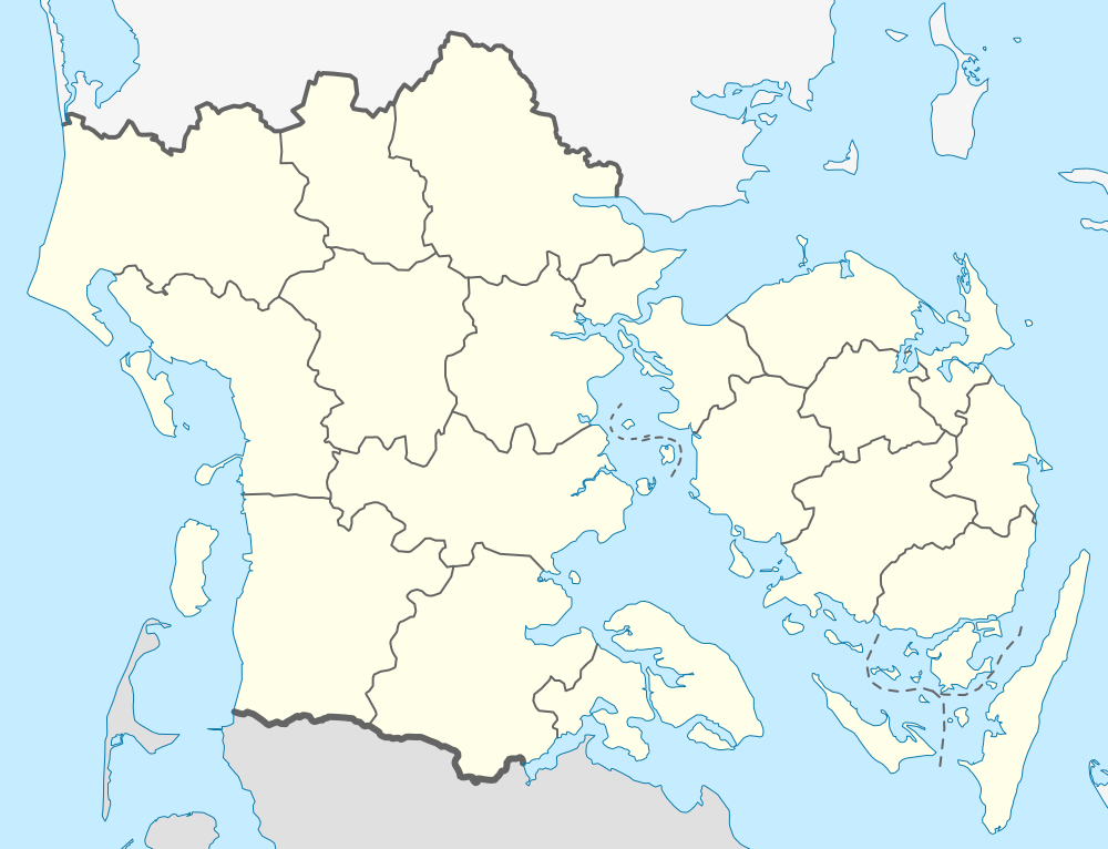
English: Location map of Region South Denmark in Denmark
Equirectangular projection, N/S stretching 177 %. Geographic limits of the map:
Deutsch: Positionskarte von der Region Syddanmark in Dänemark
Quadratische Plattkarte, N-S-Streckung 177 %. Geographische Begrenzung der Karte:
|
| Fecha | |
| Fuente | Trabajo propio |
| Autor | Erik Frohne |
| SVG desarrollo |
Licencia
Yo, titular de los derechos de autor de esta obra, la publico en los términos de las siguientes licencias:

|
Se autoriza la copia, distribución y modificación de este documento bajo los términos de la licencia de documentación libre GNU, versión 1.2 o cualquier otra que posteriormente publique la Fundación para el Software Libre; sin secciones invariables, textos de portada, ni textos de contraportada. Se incluye una copia de la dicha licencia en la sección titulada Licencia de Documentación Libre GNU. |
Este archivo se encuentra bajo la licencia Creative Commons Genérica de Atribución/Compartir-Igual 3.0.
- Eres libre:
- de compartir – de copiar, distribuir y transmitir el trabajo
- de remezclar – de adaptar el trabajo
- Bajo las siguientes condiciones:
- atribución – Debes otorgar el crédito correspondiente, proporcionar un enlace a la licencia e indicar si realizaste algún cambio. Puedes hacerlo de cualquier manera razonable pero no de manera que sugiera que el licenciante te respalda a ti o al uso que hagas del trabajo.
- compartir igual – En caso de mezclar, transformar o modificar este trabajo, deberás distribuir el trabajo resultante bajo la misma licencia o una compatible como el original.
Puedes usar la licencia que prefieras.
Historial del archivo
Haz clic sobre una fecha y hora para ver el archivo tal como apareció en ese momento.
| Fecha y hora | Miniatura | Dimensiones | Usuario | Comentario | |
|---|---|---|---|---|---|
| actual | 13:28 13 ene 2010 | | 1000 × 766 (252 kB) | Erik Frohne | Reverted to version as of 18:51, 10 March 2009:Colors as agreed upon by german and french map makers. Use file Denmark South Denmark location map (da).svg instead if you need other colors |
| 01:36 29 dic 2009 |  | 783 × 600 (1,35 MB) | Hubertus45 | Changing colour after consensus with other users. | |
| 23:44 14 dic 2009 |  | 783 × 600 (1,35 MB) | Hubertus45 | Making the region more visible to the neighbour areas. | |
| 23:38 14 dic 2009 |  | 783 × 600 (1,35 MB) | Hubertus45 | Making the region more visible to the neighbour areas. | |
| 18:51 10 mar 2009 |  | 1000 × 766 (252 kB) | Erik Frohne | {{Information |Description={{en|1=Location map of Region South Denmark in Denmark Equirectangular projection, N/S stretching 177 %. Geographic limits of the map: * N: 56.00° N * S: 54.70° N * W: 8.00° E * E: 11.00° E}} {{de|1=Positionskarte von der |
Usos del archivo
La siguiente página usa este archivo:
Uso global del archivo
Las wikis siguientes utilizan este archivo:
- Uso en ba.wikipedia.org
- Uso en ce.wikipedia.org
- Uso en de.wikipedia.org
- Ny Lillebæltsbro
- Lillebæltsbroen
- Langelandsbroen
- Augustenborg Kommune
- Gram Kommune
- Schloss Sonderburg
- Rømø Havn
- Wikipedia:Kartenwerkstatt/Positionskarten/Europa
- Blue Water Arena
- Vorlage:Positionskarte Dänemark Syddanmark
- Hørup Hav
- Brücke über die Ravning Enge
- Sydbank Park
- Nature Energy Park
- Vejle Stadion
- Svendborgsundbroen
- Kraftwerk Esbjerg
- Alssundbroen
- Kong Christian den X’s Bro
- Egernsundbroen
- Vejlefjordbroen
- Aabenraa Havn
- Kolding Havn
- Siødæmningen
- Odense Isstadion
- Granly Hockey Arena
- Blåvandshuk Fyr
- Keldsnor Fyr
- Militärflugplatz Skrydstrup
- Arena Fyn
- Gammel Pøl Fyr
- Flughafen Odense
- Dreiband-Europameisterschaft 1988
- Dreiband-Europameisterschaft 1994
- Dreiband-Europameisterschaft 2001
- Blåvands Huk
- Dreiband-Europameisterschaft 2009
- Kegnæs Fyr
- Helnæs Fyr
- Knudshoved Fyr
- Skodsbøl Fyr
- Rinkenæs Fyr
- Lågemade Fyr
- Frøs Arena
- Thorvald Ellegaard Arena
- Skjoldnæs Fyr
Ver más uso global de este archivo.