Archivo:Floating Harbour from Bristol Bridge - geograph.org.uk - 407855.jpg
No se dispone de una resolución más alta.
Floating_Harbour_from_Bristol_Bridge_-_geograph.org.uk_-_407855.jpg (640 × 480 píxeles; tamaño de archivo: 96 kB; tipo MIME: image/jpeg)
Resumen
| Descripción |
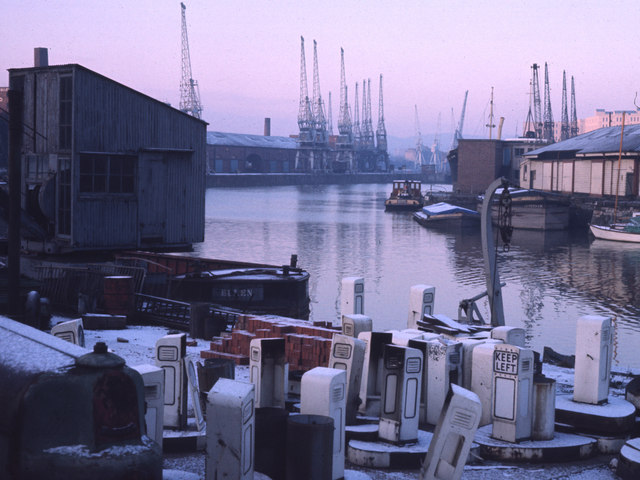
English: Floating Harbour from Bristol Bridge This photograph was taken by my father in 1971, and shows the City Docks looking West from the South Side by Bristol Bridge. The two buildings on the right are (left to right) the Port Police Headquarters, now the River Station restaurant, and a boathouse built by Brunel, now the Severnshed restaurant. The housing development at Merchants Quay now occupies the site of the transit sheds in the middle distance. Comment by User:Jezhotwells: Actually this must be taken from Redcliffe Bridge, not Bristol Bridge as these building are not visible form Bristol Bridge. |
| Fecha | |
| Fuente | From geograph.org.uk |
| Autor | Chris Heaton |
| Posición de la cámara | | Ubicación de esta y otras imágenes en: OpenStreetMap |
|---|
_heading:247.00&language=es)
| Ubicación del objeto | | Ubicación de esta y otras imágenes en: OpenStreetMap |
|---|
_heading:247.00&language=es)
Licencia

|
Esta imagen proviene de la colección del proyecto Geograph British Isles. Veáse la página de esta fotografía en el sitio web de Geograph para más información del fotógrafo. El titular de los derechos de autor de esta imagen es Chris Heaton y autoriza utilizarla bajo la licencia Reconocimiento-CompartirIgual 2.0 de Creative Commons.
|
Este archivo se encuentra bajo la licencia Creative Commons Genérica de Atribución/Compartir-Igual 2.0.
Atribución: Chris Heaton
- Eres libre:
- de compartir – de copiar, distribuir y transmitir el trabajo
- de remezclar – de adaptar el trabajo
- Bajo las siguientes condiciones:
- atribución – Debes otorgar el crédito correspondiente, proporcionar un enlace a la licencia e indicar si realizaste algún cambio. Puedes hacerlo de cualquier manera razonable pero no de manera que sugiera que el licenciante te respalda a ti o al uso que hagas del trabajo.
- compartir igual – En caso de mezclar, transformar o modificar este trabajo, deberás distribuir el trabajo resultante bajo la misma licencia o una compatible como el original.
Historial del archivo
Haz clic sobre una fecha y hora para ver el archivo tal como apareció en ese momento.
| Fecha y hora | Miniatura | Dimensiones | Usuario | Comentario | |
|---|---|---|---|---|---|
| actual | 21:31 3 feb 2011 | | 640 × 480 (96 kB) | GeographBot | == {{int:filedesc}} == {{Information |description={{en|1=Floating Harbour from Bristol Bridge This photograph was taken by my father in 1971, and shows the City Docks looking West from the South Side by Bristol Bridge. The two buildings on the right are ( |
Usos del archivo
La siguiente página usa este archivo:
Uso global del archivo
Las wikis siguientes utilizan este archivo:
- Uso en ar.wikipedia.org
- Uso en en.wikipedia.org