Archivo:KCMH Airport Map.png
Tamaño de esta previsualización: 800 × 521 píxeles. Otras resoluciones: 320 × 208 píxeles · 640 × 417 píxeles · 1024 × 667 píxeles · 1280 × 834 píxeles · 1980 × 1290 píxeles.
Ver la imagen en su resolución original (1980 × 1290 píxeles; tamaño de archivo: 215 kB; tipo MIME: image/png)
Resumen
| Descripción |
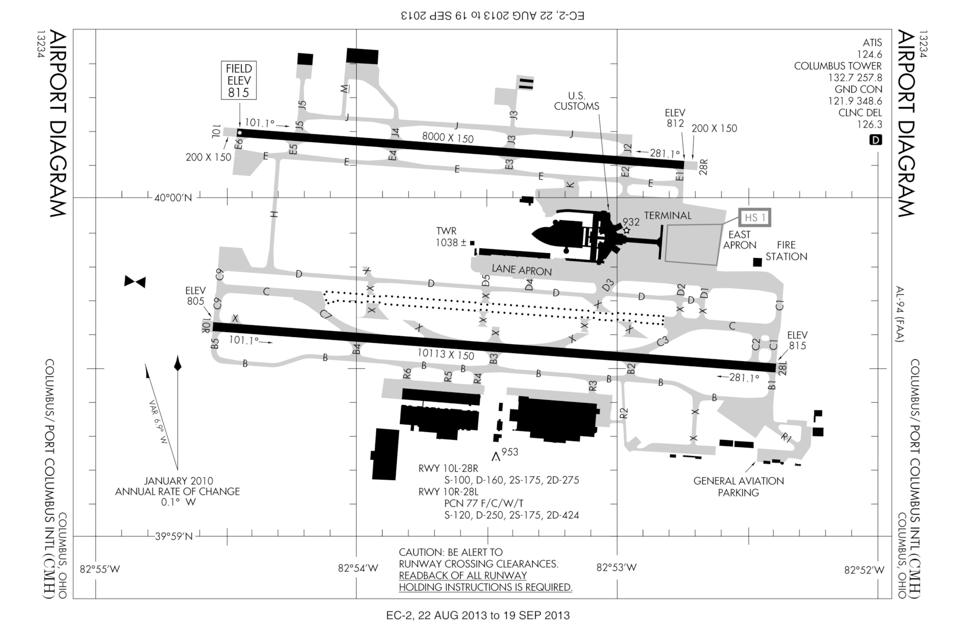
English: FAA diagram for en:Port Columbus International Airport (CMH) in Columbus, Ohio, United States. en:commons:category:Port Columbus International Airport en:commons:category:Federal Aviation Administration en:commons:category:Maps |
|||
| Fecha |
|
|||
| Fuente |
http://naco.faa.gov/d-tpp/0709/00094AD.PDF Note: this URL changes monthly, for current diagram see: |
|||
| Autor |
The original uploader was Polypmaster de Wikipedia en inglés. |


Licencia
This image or file is a work of a Federal Aviation Administration employee, taken or made as part of that person's official duties. As a work of the U.S. federal government, the image is in the public domain in the United States.
|
 |
Registro original de carga
Transferido desde en.wikipedia a Commons por Nobunaga24.
Aquí se muestra la página de descripción original. Los siguientes nombres de usuario se refieren a en.wikipedia.
- 2007-08-17 02:27 Polypmaster 537×768×8 (74297 bytes) {{Information | Description = FAA diagram for [[Port Columbus International Airport]] (CMH) in Columbus, Ohio, United States. | Source = http://naco.faa.gov/d-tpp/0709/00094AD.PDF<br/>Note: this URL changes monthly, for current diagram see:
Historial del archivo
Haz clic sobre una fecha y hora para ver el archivo tal como apareció en ese momento.
| Fecha y hora | Miniatura | Dimensiones | Usuario | Comentario | |
|---|---|---|---|---|---|
| actual | 23:46 22 ago 2013 | | 1980 × 1290 (215 kB) | VidTheKid~commonswiki | New version effective 22 August 2013 – 19 September 2013. Notable changes: new runway 10R/28L open; taxiway redesignations. |
| 05:29 9 mar 2013 |  | 3360 × 2304 (277 kB) | VidTheKid~commonswiki | Updated to new edition valid 7 March to 4 April 2013. Notable changes: outline of new runway under construction, relocated Taxiway B | |
| 10:09 25 abr 2011 |  | 2475 × 1613 (237 kB) | VidTheKid~commonswiki | This version effective 5 May to 2 June 2011. Notable changes: 1) Landscape orientation to reflect orientation of most labels, as well as to point north up; 2) New taxiway H (built 2009); 3) Most of taxiway B and adjacent taxiways closed as construction o | |
| 05:42 1 may 2008 |  | 537 × 768 (73 kB) | File Upload Bot (Magnus Manske) | {{BotMoveToCommons|en.wikipedia}} {{Information |Description={{en|FAA diagram for en:Port Columbus International Airport (CMH) in Columbus, Ohio, United States.<br/> en:commons:category:Port Columbus International Airport [[:en:commons:categor |
Usos del archivo
La siguiente página usa este archivo:
Uso global del archivo
Las wikis siguientes utilizan este archivo:
- Uso en en.wikipedia.org