Archivo:Kennington Park - geograph.org.uk - 1009307.jpg
No se dispone de una resolución más alta.
Kennington_Park_-_geograph.org.uk_-_1009307.jpg (640 × 480 píxeles; tamaño de archivo: 220 kB; tipo MIME: image/jpeg)
Resumen
| Descripción |
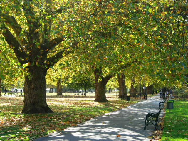
English: Kennington Park Kennington Park was originally common land, but was laid out as a park in the mid-19th century. In the 17th and 18th centuries it was the site of public executions and in 1848 a major chartist rally was held here which led directly to a change in the law extending the franchise in 1852. During the Second World War a communal shallow-trench air raid shelter was built here which suffered a direct hit in October 1940 killing at least 46 people. The full story of this terrible event is told here: http://www.vauxhallandkennington.org.uk/forgottentragedy.pdf . |
| Fecha | |
| Fuente | From geograph.org.uk |
| Autor | Stephen McKay |
| Atribución (requerido por la licencia) | Stephen McKay / Kennington Park / |
| Posición de la cámara | | Ubicación de esta y otras imágenes en: OpenStreetMap |
|---|
_heading:180.00&language=es)
| Ubicación del objeto | | Ubicación de esta y otras imágenes en: OpenStreetMap |
|---|
_heading:180.00&language=es)
Licencia

|
Esta imagen proviene de la colección del proyecto Geograph British Isles. Veáse la página de esta fotografía en el sitio web de Geograph para más información del fotógrafo. El titular de los derechos de autor de esta imagen es Stephen McKay y autoriza utilizarla bajo la licencia Reconocimiento-CompartirIgual 2.0 de Creative Commons.
|
Este archivo se encuentra bajo la licencia Creative Commons Genérica de Atribución/Compartir-Igual 2.0.
Atribución: Stephen McKay
- Eres libre:
- de compartir – de copiar, distribuir y transmitir el trabajo
- de remezclar – de adaptar el trabajo
- Bajo las siguientes condiciones:
- atribución – Debes otorgar el crédito correspondiente, proporcionar un enlace a la licencia e indicar si realizaste algún cambio. Puedes hacerlo de cualquier manera razonable pero no de manera que sugiera que el licenciante te respalda a ti o al uso que hagas del trabajo.
- compartir igual – En caso de mezclar, transformar o modificar este trabajo, deberás distribuir el trabajo resultante bajo la misma licencia o una compatible como el original.
Historial del archivo
Haz clic sobre una fecha y hora para ver el archivo tal como apareció en ese momento.
| Fecha y hora | Miniatura | Dimensiones | Usuario | Comentario | |
|---|---|---|---|---|---|
| actual | 07:36 23 feb 2011 | | 640 × 480 (220 kB) | GeographBot | == {{int:filedesc}} == {{Information |description={{en|1=Kennington Park Kennington Park was originally common land, but was laid out as a park in the mid-19th century. In the 17th and 18th centuries it was the site of public executions and in 1848 a maj |
Usos del archivo
La siguiente página usa este archivo:
Uso global del archivo
Las wikis siguientes utilizan este archivo:
- Uso en ar.wikipedia.org
- Uso en azb.wikipedia.org
- Uso en en.wikipedia.org
- Uso en fa.wikipedia.org
- Uso en fi.wikipedia.org
- Uso en id.wikipedia.org
- Uso en pl.wikipedia.org
- Uso en pt.wikipedia.org
- Uso en ru.wikipedia.org
- Uso en sv.wikipedia.org
- Uso en www.wikidata.org
- Uso en zh.wikipedia.org