Archivo:Legend of Nazaré (5669344542).jpg
Tamaño de esta previsualización: 400 × 600 píxeles. Otras resoluciones: 160 × 240 píxeles · 320 × 480 píxeles · 512 × 768 píxeles · 682 × 1024 píxeles · 1365 × 2048 píxeles · 3096 × 4644 píxeles.
Ver la imagen en su resolución original (3096 × 4644 píxeles; tamaño de archivo: 4,6 MB; tipo MIME: image/jpeg)
.jpg?uselang=es)
Resumen
| Descripción |
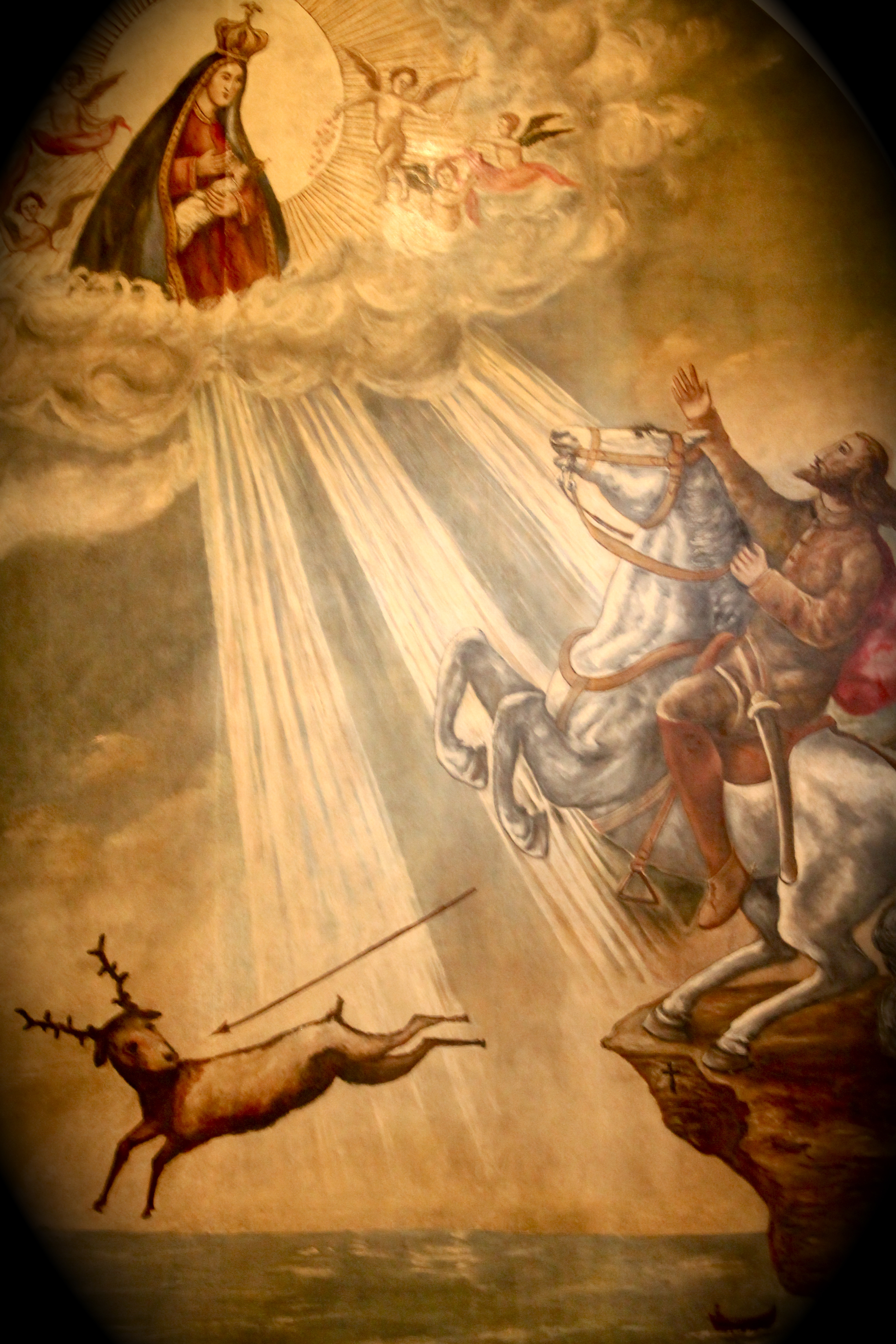
Portugal en.wikipedia.org/wiki/Nazar%C3%A9_(Portugal)#legend-d-fuas The first church in O Sítio, was built over the grotto to commemorate a miraculous intervention (1182) by the Virgin Mary in saving the life of the 12th century Portuguese knight Dom Fuas Roupinho, possibly a templar, while he was hunting deer one foggy early morning. In memory of the miracle he had a chapel (Capela da Memória) built over the small grotto, where the miraculous statue had been left (c.715) by king Roderic after the monk's death. Beside the chapel, on a protuberant rock 110 meters above the Atlantic, one can still see the mark made in the rock by one of the hooves of Dom Fuas horse. |
| Fecha | |
| Fuente |
|
| Autor | André Luís from Lisbon, Portugal |
| Posición de la cámara | | Ubicación de esta y otras imágenes en: OpenStreetMap |
|---|
.jpg¶ms=039.605588_N_-009.076809_E_globe:Earth_type:camera_source:Flickr_&language=es)
Licencia
Este archivo está disponible bajo la licencia Creative Commons Atribución 2.0 Genérica.
- Eres libre:
- de compartir – de copiar, distribuir y transmitir el trabajo
- de remezclar – de adaptar el trabajo
- Bajo las siguientes condiciones:
- atribución – Debes otorgar el crédito correspondiente, proporcionar un enlace a la licencia e indicar si realizaste algún cambio. Puedes hacerlo de cualquier manera razonable pero no de manera que sugiera que el licenciante te respalda a ti o al uso que hagas del trabajo.
| Esta imagen, originalmente subida a Flickr, fue revisada el 29 de enero de 2013 por el administrador o revisor File Upload Bot (Magnus Manske), quien comprobó que el archivo se encontraba disponible en Flickr bajo la licencia nombrada en dicha fecha. |
Historial del archivo
Haz clic sobre una fecha y hora para ver el archivo tal como apareció en ese momento.
| Fecha y hora | Miniatura | Dimensiones | Usuario | Comentario | |
|---|---|---|---|---|---|
| actual | 00:26 29 ene 2013 | | 3096 × 4644 (4,6 MB) | File Upload Bot (Magnus Manske) | Transferred from Flickr by User:tm |
Usos del archivo
Las siguientes páginas usan este archivo:
Uso global del archivo
Las wikis siguientes utilizan este archivo:
- Uso en en.wikipedia.org
- Uso en fr.wikipedia.org
- Uso en it.wikipedia.org
- Uso en pt.wikipedia.org
- Uso en sl.wikipedia.org
- Uso en www.wikidata.org
- Uso en zh.wikipedia.org
.jpg)