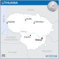
Archivo:Lithuania - Location Map (2013) - LTU - UNOCHA.svg

Ver la imagen en su resolución original ((Imagen SVG, nominalmente 251 × 251 pixels, tamaño de archivo: 936 kB))

Renderizar esta imagen en .

Resumen

Descripción
English: Locator map of Lithuania.
Fecha
Fuente
English: Lithuania Locator Map (ReliefWeb), ESRI, UNCS, Natural Earth, FAO
Autor
SVG desarrollo
InfoField
 
El código fuente de esta imagen SVG es válido.
 
Este mapa fue creado con Inkscape.
 
 This map uses embedded text that can be easily translated using a text editor.

Licencia

w:es:Creative Commons
atribución
Este archivo se encuentra bajo la licencia Creative Commons Atribución 3.0 Unported.
Atribución: OCHA
Eres libre:
  • de compartir – de copiar, distribuir y transmitir el trabajo
  • de remezclar – de adaptar el trabajo
Bajo las siguientes condiciones:
  • atribución – Debes otorgar el crédito correspondiente, proporcionar un enlace a la licencia e indicar si realizaste algún cambio. Puedes hacerlo de cualquier manera razonable pero no de manera que sugiera que el licenciante te respalda a ti o al uso que hagas del trabajo.
This map is part of a collection of 216 free country maps, created by the UN Office for the Coordination of Humanitarian Affairs (OCHA), to be used in print, web or broadcast products.

The ReliefWeb Location Maps released here are maps that highlight a country, its capital, major populated places and the surrounding regions.

Attribution Requirements

Using the map without modifications: ensure that the sources and the disclaimer are below the map. Credit as follows: "Credit: OCHA".

For use with alteration: remove the OCHA logo and disclaimer following any modification to the map, but keep the data sources as mentioned below the map. Credit the modified map as follows: "Based on OCHA map". You are responsible for the content of your map.

We are keen to receive your feedback and hear how you used OCHA's maps. We would be grateful if you would notify us by e-mail and share your work with us.

UN Disclaimer
The designations employed and the presentation of material of this map do not imply the expression of any opinion whatsoever on the part of the Secretariat of the United Nations concerning the legal status of any country, territory, city or area or of its authorities or concerning the delimitation of its frontiers or boundaries.
VRT Wikimedia

Esta obra es libre y puede ser utilizada por cualquiera para cualquier propósito. Si usted desea utilizar este contenido fuera de Wikimedia, no necesitará pedir permiso mientras sigua las condiciones de la licencia explicitadas en esta página.

Wikimedia ha recibido un correo electrónico que confirma que el titular de los derechos de autor ha aprobado la publicación y la reutilización de la obra bajo las condiciones que se mencionan en esta página. La correspondencia ha sido revisada por un miembro de VRT y ha sido guardada en nuestro sistema. El texto de la correspondencia está disponible solo para voluntarios confiables bajo el Ticket #2014031410007248. Enlace al permiso: https://ticket.wikimedia.org/otrs/index.pl?Action=AgentTicketZoom&TicketNumber=2014031410007248
Find other files from the same ticket: SDC query (SPARQL)

Leyendas

Añade una explicación corta acerca de lo que representa este archivo

Elementos representados en este archivo

representa a

image/svg+xml

Historial del archivo

Haz clic sobre una fecha y hora para ver el archivo tal como apareció en ese momento.

Fecha y horaMiniaturaDimensionesUsuarioComentario
actual15:44 1 jun 2024Miniatura de la versión del 15:44 1 jun 2024251 × 251 (936 kB)J4keeS237File uploaded using svgtranslate tool (https://svgtranslate.toolforge.org/). Added translation for ka.
15:39 1 jun 2024Miniatura de la versión del 15:39 1 jun 2024251 × 251 (936 kB)J4keeS237File uploaded using svgtranslate tool (https://svgtranslate.toolforge.org/). Added translation for ka.
15:35 24 dic 2022Miniatura de la versión del 15:35 24 dic 2022251 × 251 (932 kB)WikijahnnFile uploaded using svgtranslate tool (https://svgtranslate.toolforge.org/). Added translation for ca.
06:40 7 sep 2016Miniatura de la versión del 06:40 7 sep 2016251 × 251 (930 kB)Wereldburger758Resized page to drawing. Removal watermark. Validation of image.
04:41 21 abr 2014Miniatura de la versión del 04:41 21 abr 2014254 × 254 (912 kB)UN OCHA maps bot== {{int:filedesc}} == {{Information |description={{en|1=Locator map of Lithuania.}} |date=2013 |source={{en|1=[http://reliefweb.int/map/lithuania/lithuania-location-map-2013 Lithuania Locator Map (ReliefWeb)]}} |author={{en|1=[[w:en...

Uso global del archivo

Las wikis siguientes utilizan este archivo:

Metadatos