Archivo:Map of New Jersey municipalities.svg

Tamaño de esta previsualización PNG del archivo SVG: 316 × 600 píxeles. Otras resoluciones: 126 × 240 píxeles · 253 × 480 píxeles · 404 × 768 píxeles · 539 × 1024 píxeles · 1079 × 2048 píxeles · 791 × 1501 píxeles.
Ver la imagen en su resolución original ((Imagen SVG, nominalmente 791 × 1501 pixels, tamaño de archivo: 365 kB))
Resumen
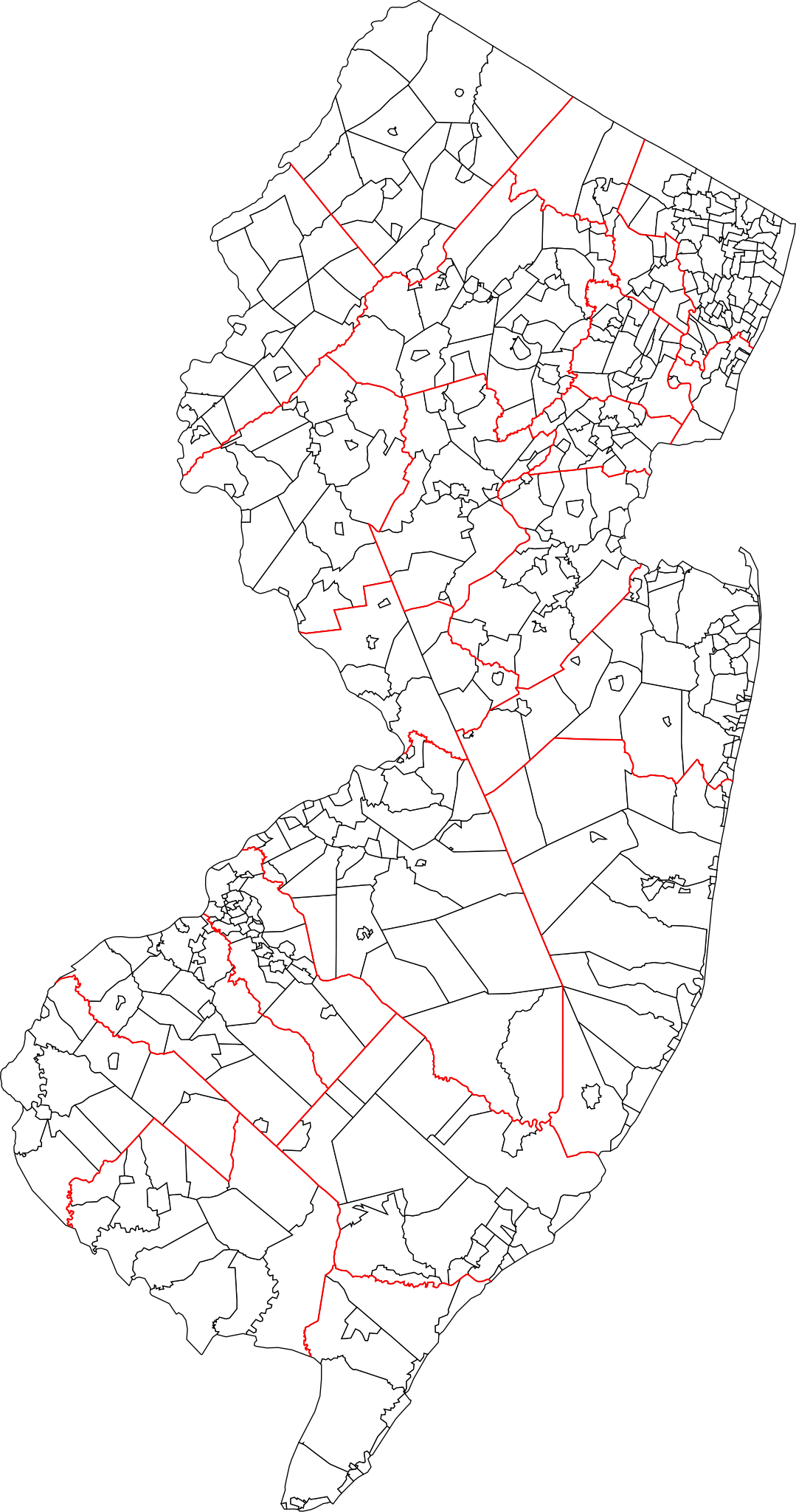
| Descripción | A blank map of all 564 New Jersey municipalities. Each of the objects' name in the svg is the name of the municipality. Red lines represent county borders |
| Fecha | |
| Fuente | Based on 1990 Cartographic Boundary Files, New Jersey County Subdivisions by the U.S. Census Bureau (public domain), modified to match current municipalities (merger of Pahaquarry and Hardwick townships, Princeton borough and township, Pine Hill and Pine Valley). |
| Autor | Mr. Matté (if there is an issue with this image, contact me using this image's Commons talk page, my Commons user talk page, or my English Wikipedia user talk page; I'll know about it a lot faster) |
Licencia
| Yo, el titular de los derechos de autor de esta obra, lo libero al dominio público. Esto aplica en todo el mundo. En algunos países esto puede no ser legalmente factible; si ello ocurriese: Concedo a cualquier persona el derecho de usar este trabajo para cualquier propósito, sin ningún tipo de condición al menos que éstas sean requeridas por la ley. |
Historial del archivo
Haz clic sobre una fecha y hora para ver el archivo tal como apareció en ese momento.
| Fecha y hora | Miniatura | Dimensiones | Usuario | Comentario | |
|---|---|---|---|---|---|
| actual | 15:11 29 ene 2022 | | 791 × 1501 (365 kB) | Mr. Matté | Updated map, now based on US Census boundary files/coordinates/NAVD datum, not traced from old map like old file |
| 00:10 3 ene 2013 |  | 1495 × 2770 (2,04 MB) | Mr. Matté | Update after consolidation of Princetons | |
| 14:39 19 abr 2008 |  | 1496 × 2770 (2,13 MB) | Mr. Matté | {{Information |Description=A blank map of all 566 New Jersey municipalities. Each of the objects' name in the svg is the name of the municipality. |Source=Based off of the various maps of indiv |
Usos del archivo
La siguiente página usa este archivo:
Uso global del archivo
Las wikis siguientes utilizan este archivo:
- Uso en ar.wikipedia.org
- Uso en en.wikipedia.org
- Uso en fa.wikipedia.org
- Uso en fr.wikipedia.org
- Uso en simple.wikipedia.org
- Uso en tr.wikipedia.org
- Uso en zh.wikipedia.org