Archivo:Map of Ohio NA.png

Tamaño de esta previsualización: 800 × 542 píxeles. Otras resoluciones: 320 × 217 píxeles · 640 × 434 píxeles · 1024 × 694 píxeles · 1280 × 867 píxeles · 1967 × 1333 píxeles.
Ver la imagen en su resolución original (1967 × 1333 píxeles; tamaño de archivo: 2,02 MB; tipo MIME: image/png)
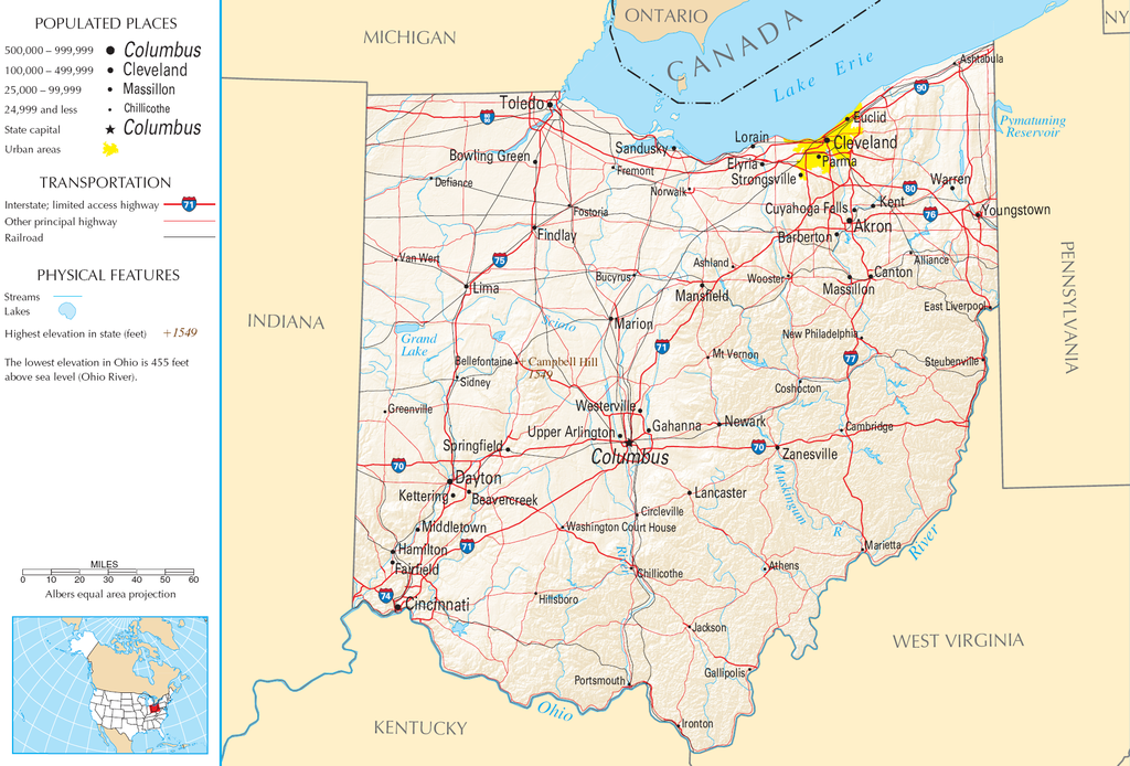
| Descripción | Map of Ohio |
| Fuente | National Atlas |
| Autor |
This map was obtained from an edition of the National Atlas of the United States. Like almost all works of the U.S. federal government, works from the National Atlas are in the public domain in the United States.
Online access: NationalAtlas.gov | 1970 print edition: Library of Congress, Perry-Castañeda Library
|
Historial del archivo
Haz clic sobre una fecha y hora para ver el archivo tal como apareció en ese momento.
| Fecha y hora | Miniatura | Dimensiones | Usuario | Comentario | |
|---|---|---|---|---|---|
| actual | 11:21 30 ago 2007 | | 1967 × 1333 (2,02 MB) | Conscious | cropped |
| 08:02 15 ago 2006 |  | 2122 × 1640 (2,17 MB) | Huebi~commonswiki | {{Information| |Description=Map of Ohio |Source=[http://www.nationalatlas.gov National Atlas] }} Category:Maps of the United States Category:Maps of Ohio {{PD-USGov-Atlas}} |
Usos del archivo
La siguiente página usa este archivo:
Uso global del archivo
Las wikis siguientes utilizan este archivo:
- Uso en arz.wikipedia.org
- Uso en de.wikipedia.org
- Uso en en.wikipedia.org
- Uso en eu.wikipedia.org
- Uso en fr.wikipedia.org
- Uso en gl.wikipedia.org
- Uso en hr.wiktionary.org
- Uso en hsb.wikipedia.org
- Uso en hu.wikipedia.org
- Uso en incubator.wikimedia.org
- Uso en io.wikipedia.org
- Uso en it.wikipedia.org
- Uso en ja.wikipedia.org
- Uso en kk.wikipedia.org
- Uso en mk.wikipedia.org
- Uso en mr.wikipedia.org
- Uso en nl.wikipedia.org
- Uso en rue.wikipedia.org
- Uso en ru.wikipedia.org
- Uso en stq.wikipedia.org
- Uso en sw.wikipedia.org
- Uso en szl.wikipedia.org
- Uso en zea.wikipedia.org