Archivo:Navigation on St Clair River.jpg

Tamaño de esta previsualización: 800 × 561 píxeles. Otras resoluciones: 320 × 224 píxeles · 640 × 448 píxeles · 1024 × 717 píxeles · 1280 × 897 píxeles · 1500 × 1051 píxeles.
Ver la imagen en su resolución original (1500 × 1051 píxeles; tamaño de archivo: 641 kB; tipo MIME: image/jpeg)
| Descripción |
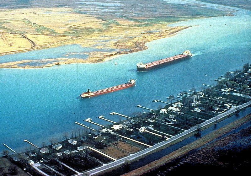
English: Great Lakes freighters navigating on the lower St. Clair River between Michigan, USA and Ontario, Canada. The view is from the American side looking across to Canada. The Walpole Island Indian Reserve is directly across on the Canadian side. |
|||
| Fecha | not specified or unknown | |||
| Fuente |
U.S. Army Corps of Engineers Digital Visual Library Image page Image description page Digital Visual Library home page |
|||
| Autor | U.S. Army Corps of Engineers, photographer not specified or unknown | |||
| Permiso (Reutilización de este archivo) |
|
|||
| Localización | St. Clair River, east of Detroit, Michigan, USA |
| Posición de la cámara | | Ubicación de esta y otras imágenes en: OpenStreetMap |
|---|
Historial del archivo
Haz clic sobre una fecha y hora para ver el archivo tal como apareció en ese momento.
| Fecha y hora | Miniatura | Dimensiones | Usuario | Comentario | |
|---|---|---|---|---|---|
| actual | 03:06 29 mar 2007 | | 1500 × 1051 (641 kB) | DanMS | {{Information | Description = {{en|Great Lakes freighters navigating on the lower St. Clair River between Michigan, USA and Ontario, Canada. The view is from the American side looking across to Canada. The Walpole Island Indian Reserve is directly acro |
Usos del archivo
La siguiente página usa este archivo:
Uso global del archivo
Las wikis siguientes utilizan este archivo:
- Uso en arz.wikipedia.org
- Uso en bg.wikipedia.org
- Uso en br.wikipedia.org
- Uso en ca.wikipedia.org
- Uso en de.wikipedia.org
- Uso en en.wikipedia.org
- Uso en en.wikivoyage.org
- Uso en eo.wikipedia.org
- Uso en fr.wikipedia.org
- Uso en it.wikipedia.org
- Uso en ja.wikipedia.org
- Uso en lt.wikipedia.org
- Uso en no.wikipedia.org
- Uso en simple.wikipedia.org
- Uso en uk.wikipedia.org
- Uso en www.wikidata.org
- Uso en zh-yue.wikipedia.org