Archivo:PIA20199-Pluto-Mountains-NearSputnikPlanum-20150714.jpg

Ver la imagen en su resolución original (4976 × 4492 píxeles; tamaño de archivo: 1,75 MB; tipo MIME: image/jpeg)
Resumen
| Descripción |
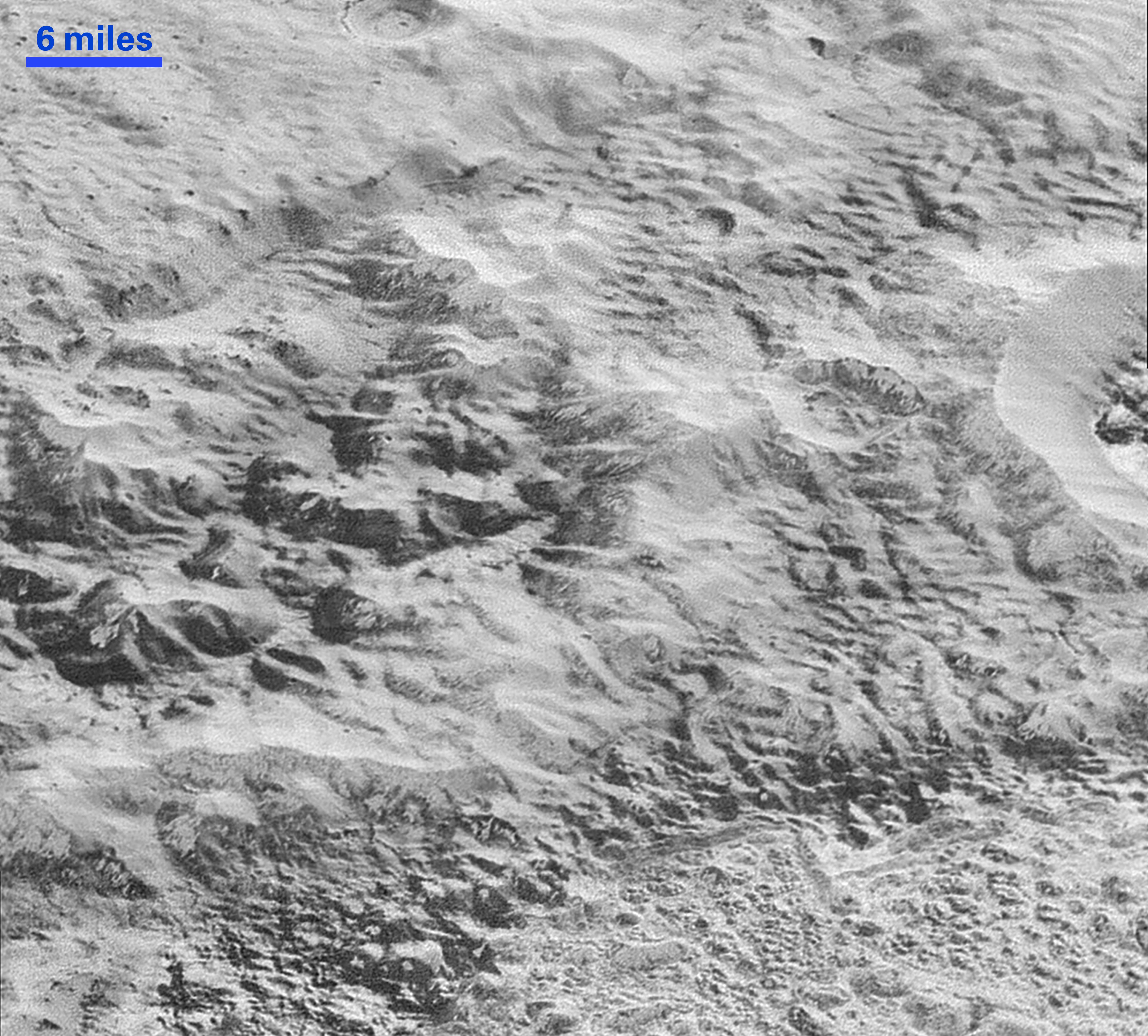
English: PIA20199: Pluto's Badlands
http://photojournal.jpl.nasa.gov/catalog/PIA20199 This highest-resolution image from NASA's New Horizons spacecraft shows how erosion and faulting has sculpted this portion of Pluto's icy crust into rugged badlands. The prominent 1.2-mile-high cliff at the top, running from left to upper right, is part of a great canyon system that stretches for hundreds of miles across Pluto's northern hemisphere. New Horizons team members think that the mountains in the middle are made of water ice, but have been modified by the movement of nitrogen or other exotic ice glaciers over long periods of time, resulting in a muted landscape of rounded peaks and intervening sets of short ridges. At the bottom of this 50-mile-wide image, the terrain transforms dramatically into a fractured and finely broken up floor at the northwest margin of the giant ice plain informally called Sputnik Planum. The top of the image is to Pluto's northwest. These images were made with the telescopic Long Range Reconnaissance Imager (LORRI) aboard New Horizons, in a timespan of about a minute centered on 11:36 UT on July 14 -- just about 15 minutes before New Horizons' closest approach to Pluto -- from a range of just 10,000 miles (17,000 kilometers). They were obtained with an unusual observing mode; instead of working in the usual "point and shoot," LORRI snapped pictures every three seconds while the Ralph/Multispectral Visual Imaging Camera (MVIC) aboard New Horizons was scanning the surface. This mode requires unusually short exposures to avoid blurring the images. The Johns Hopkins University Applied Physics Laboratory in Laurel, Maryland, designed, built, and operates the New Horizons spacecraft, and manages the mission for NASA's Science Mission Directorate. The Southwest Research Institute, based in San Antonio, leads the science team, payload operations and encounter science planning. New Horizons is part of the New Frontiers Program managed by NASA's Marshall Space Flight Center in Huntsville, Alabama. |
| Fecha | |
| Fuente | http://photojournal.jpl.nasa.gov/jpeg/PIA20199.jpg |
| Autor | NASA/Johns Hopkins University Applied Physics Laboratory/Southwest Research Institute |
Licencia
| Este archivo es de dominio público porque fue creado por la NASA. Las políticas sobre copyright de la NASA estipulan que «el material de la NASA no está protegido con copyright a menos que se indique lo contrario». (Políticas sobre copyright de la NASA o Políticas sobre la utilización de imágenes del Jet Propulsion Laboratory). | ||
 |
Advertencias:
|
Historial del archivo
Haz clic sobre una fecha y hora para ver el archivo tal como apareció en ese momento.
| Fecha y hora | Miniatura | Dimensiones | Usuario | Comentario | |
|---|---|---|---|---|---|
| actual | 17:22 6 dic 2015 | | 4976 × 4492 (1,75 MB) | Drbogdan | User created page with UploadWizard |
Usos del archivo
La siguiente página usa este archivo:
Uso global del archivo
Las wikis siguientes utilizan este archivo:
- Uso en en.wikipedia.org