Archivo:Roman Fort and the Antonine Wall - geograph.org.uk - 1449013.jpg
No se dispone de una resolución más alta.
Roman_Fort_and_the_Antonine_Wall_-_geograph.org.uk_-_1449013.jpg (640 × 480 píxeles; tamaño de archivo: 55 kB; tipo MIME: image/jpeg)
Resumen
| Descripción |
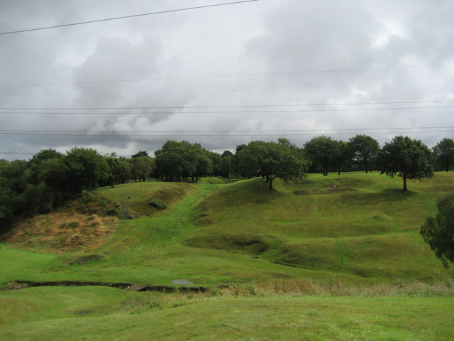
English: Roman Fort and the Antonine Wall The ditch, clearly seen in a lighter shade of green, marks the course of the Antonine Wall - the most north westerly frontier achieved by the Roman Empire. I believe it was only in use for little over 20 years. To the right are ridges and mounds that indicate the position of the Roman Fort at Rough Castle - the whole scene reminds me of a golf course. |
| Fecha | |
| Fuente | From geograph.org.uk |
| Autor | Chris Heaton |
| Atribución (requerido por la licencia) | Chris Heaton / Roman Fort and the Antonine Wall / |
| Posición de la cámara | | Ubicación de esta y otras imágenes en: OpenStreetMap |
|---|
_heading:67.00&language=es)
| Ubicación del objeto | | Ubicación de esta y otras imágenes en: OpenStreetMap |
|---|
_heading:67.00&language=es)
Licencia

|
Esta imagen proviene de la colección del proyecto Geograph British Isles. Veáse la página de esta fotografía en el sitio web de Geograph para más información del fotógrafo. El titular de los derechos de autor de esta imagen es Chris Heaton y autoriza utilizarla bajo la licencia Reconocimiento-CompartirIgual 2.0 de Creative Commons.
|
Este archivo se encuentra bajo la licencia Creative Commons Genérica de Atribución/Compartir-Igual 2.0.
Atribución: Chris Heaton
- Eres libre:
- de compartir – de copiar, distribuir y transmitir el trabajo
- de remezclar – de adaptar el trabajo
- Bajo las siguientes condiciones:
- atribución – Debes otorgar el crédito correspondiente, proporcionar un enlace a la licencia e indicar si realizaste algún cambio. Puedes hacerlo de cualquier manera razonable pero no de manera que sugiera que el licenciante te respalda a ti o al uso que hagas del trabajo.
- compartir igual – En caso de mezclar, transformar o modificar este trabajo, deberás distribuir el trabajo resultante bajo la misma licencia o una compatible como el original.
Historial del archivo
Haz clic sobre una fecha y hora para ver el archivo tal como apareció en ese momento.
| Fecha y hora | Miniatura | Dimensiones | Usuario | Comentario | |
|---|---|---|---|---|---|
| actual | 02:54 2 mar 2011 | | 640 × 480 (55 kB) | GeographBot | == {{int:filedesc}} == {{Information |description={{en|1=Roman Fort and the Antonine Wall The ditch, clearly seen in a lighter shade of green, marks the course of the Antonine Wall - the most north westerly frontier achieved by the Roman Empire. I believ |
Usos del archivo
La siguiente página usa este archivo:
Uso global del archivo
Las wikis siguientes utilizan este archivo:
- Uso en en.wikipedia.org
- Uso en fa.wikipedia.org